

Old Versions of the St. Jacques Map
This page details some of the old versions of the map, from the initial sketches to the different attempts at digital versions.
Initial Sketches
 |
 |
 |
These essential doodles show the initial plans for the map. It is interesting to compare these sketches with the final version of the map. It has come so far!
Unlike the Conapega/Napega/Dame Alice Owen's School Metro Map, it was decided to sketch the entire map in full, rather than create separate lines. This meant that the map would be far more coherent and realistic. With Napega, the focus was to have as many interchanges as possible (a few stations would interchange with almost every line, Gabriel Glider station would be the hub station and would be served by each line on the system). For this new map, there would still be opportunity for interchanges, but they would be focused in the centre.
Sketch 1
This map can also be viewed on my Instagram page.
The target was a system of 20 metro lines. No other metro system at the time had this many distinct lines. Jacques Central would be the hub of the network. Generally, many features of the map here can still be seen in the latest versions. Station names were for the most part not decided yet, only placeholder names were given for stations.
There were some lines of note. The central circle, Line 1, coloured black, is a prominent feature on the map, right from day one. This was always the intention. This circle, encompassing central St. Jacques, was initially planned to house every single fellow chemistry student in my year. This was a group of 140 people. The rest of the map would have been huge as a result! Line 1 eventually ended up having just 53 stations, far more realistic.
Stations: Ker's Kat (Kerry's Cat), Spen (Daniel), Dongwhi, Robo (Oliver), Skan (Skantaar), Nathaniel, Carr (Josh), Cameron, Wendy (???), Raj (Andrew), Catford, Ill (Mike), Sim (Simran), Adit (Aditya), Nikit (Nikita), Harvey (Harveen), Juhin, Sapsford, Jer (Jeroen), Zai (Zainab), Pash (Pashiini), Tani (Tanitha), Are (Areeb), Meera, Jenny, Turk (Lukas), Jasp (Jasper), Grif (Griffiths), Gina, Shab (Shababa), Nas, Marcus (Markus). It is a mystery to me who Wendy is supposed to be, I only know one Wendy and I only met her after uni!
Line 4, coloured purple, would be intended to house all my floormates on the fourth floor of Gabor Hall in my first year of university. Hence the line number. This line was an odd one, not cutting through the centre of the city, instead starting from St. Jacques and heading to the deepest south.
Stations: Jac (Jacques Central), Vasa, Jel (Alex), Jam (Jamielyn), Dhar (Dharani), Cli (Clinton), Gre (Gregor), Juhin, Led (Will), Jam (James), Vin (Jasper), Amrit, Inch (In-Chan), Duf (Thomas), Fab (Fabian), Den (Denholm), Ed, Kar (Giorgos), Mac (Maciek).
Line 20, coloured in mint green, was a curious line. This would be the only line not to serve St. Jacques, instead a crosstown line in the north-east of the city. This line would be intended for my baseball teammates, the Imperial Falcons. A little vestige of a service to start with, this little line would come so far, and today it is part of a humongous St. Jacques Overground network.
Stations: Marcel, Col (Sam), Har (Dan), Vin (Vincent).
The other line of note is the original Line 17. This lilac line formed an outer circle, but only through the southern half of the city. A small branch would connect the line into the centre - at Jeroen station. A very odd line indeed, it would be a strange operation - the feeder branch from Jeroen would have likely been quite busy. Curiously, the eastern end of this line comes very close to touching the aforementioned Line 20. Though not thought of at the time, this was a very early sign of the Overground service.
Most lines are generally similar to today's map, however there are a few branches which would be added later. Curiously, some lines terminated in central St. Jacques, on an interchange with Line 1.
Line 2 is missing an eastern branch. Line 6 is missing a western branch. Line 7 is missing a western branch. The eastern end of Line 10 terminates on the central circle. Line 12 does not leave central St. Jacques (only in the latest hand-drawn version does it get extended)! Line 14 only goes as far north as the edge of the central circle, as does Line 15. Line 16 is slightly different to the line today. Line 19 is labelled in the key at the bottom, however it has not been drawn in this doodle.
In the scan, Line 8 has since completely faded, but can be seen more clearly in the Instagram post.
Sketch 2
The map is a little more fleshed out, Line 19 finally makes an appearance. The map is generally a neater version of the previous sketch. Of note here, Line 17 is more fleshed out in central St. Jacques, but this magnifies the 'reverse-branching' of the line!
This sketch is particularly curious as this is the only version of the map, until Version 4, where there is a river present. Also marked on the eastern end is the location of the ocean, as intended.
Sketch 3
This sketch puts into focus the central section of the map. Apart from the circle line, there are no labels on the map. In consequence, this map does not show Line 20 at all.
The key to lines here is quite detailed, it shows the opening date of the first section of the line, as well as the train stock it operates. Also on the map is a mouse character in the top-right corner. Tube mice would be intended as the mascot of the system, so I included a funny mouse inside a weather-vane to denote directions. Sadly, I only carried this feature through to the first version of the full map, however there is still a chance to add it to the latest version (my drawing skills have certainly improved)!
Previous Versions
 |
 |
 |
 |
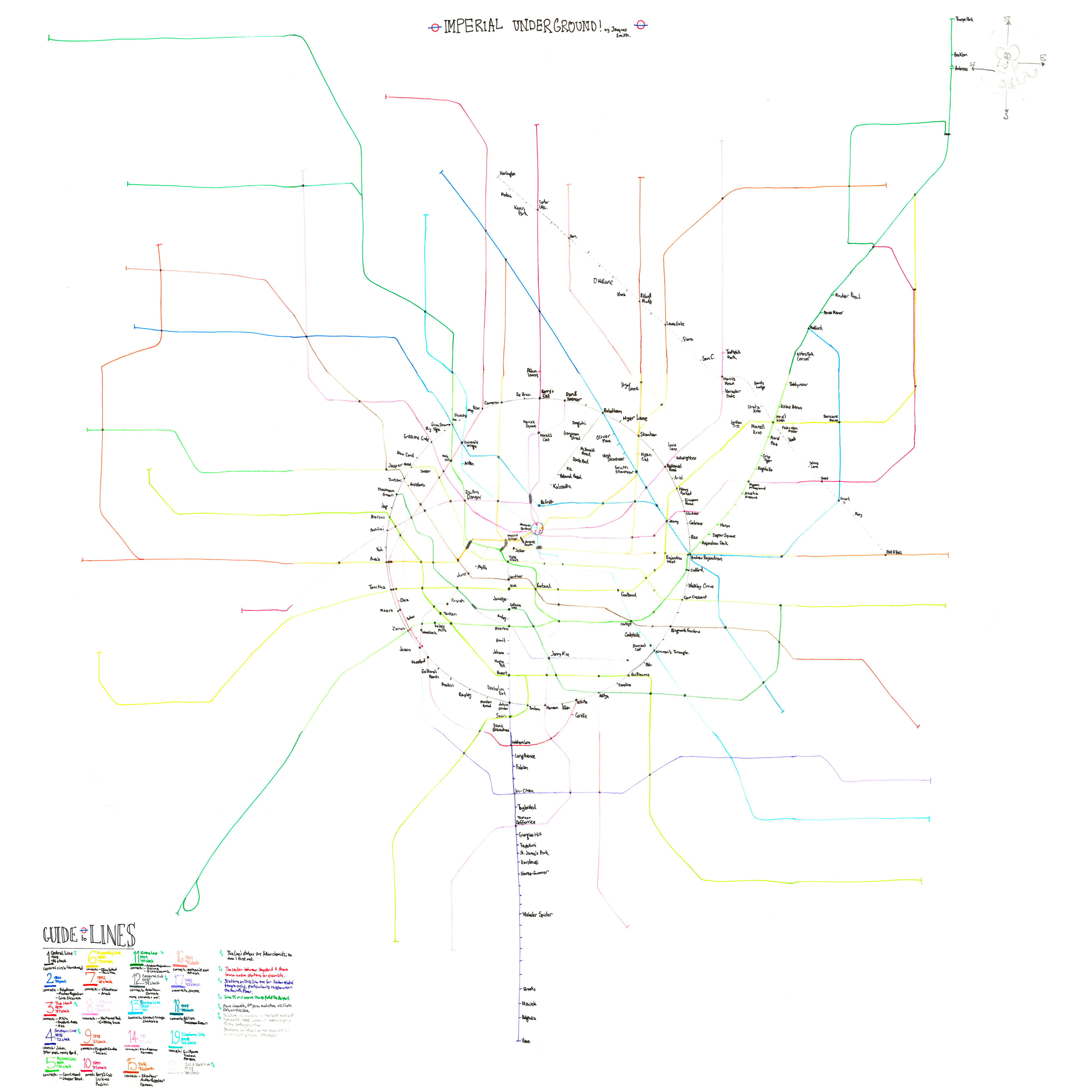
Version 1
November 2012. With the third sketch not going into too much detail, at the end of a particularly rainy weekend back at home from university, I would decide to start drawing the map in full. I started the map in pencil, but it was time for me to return back to campus. I forgot to take coloured pencils with me, however I was inspired enough to continue drawing the map, continuing on with similarly-coloured Stabilo pens. This is why the map looks quite fragmented, though it is certainly neater than any sketches before it.
Drawn on 3 sheets of A3 paper and 6 sheets of A4 paper, the map had two keys originally, one on the bottom-left corner of the centre page, and the main key on the bottom left. As this was still a working draft in my eyes, I had doodled all over the map, testing out pencils, scribbling parts of lines out, and drawing smiley faces. For the restoration of this map, I decided to remove the first key, and have removed all scribbles and rogue smiley faces.
Sadly, the map has rather faded being so old - Line 16 in particular with its peach colour can barely be seen through the centre, however you can just about make it out, or at least follow its trace.
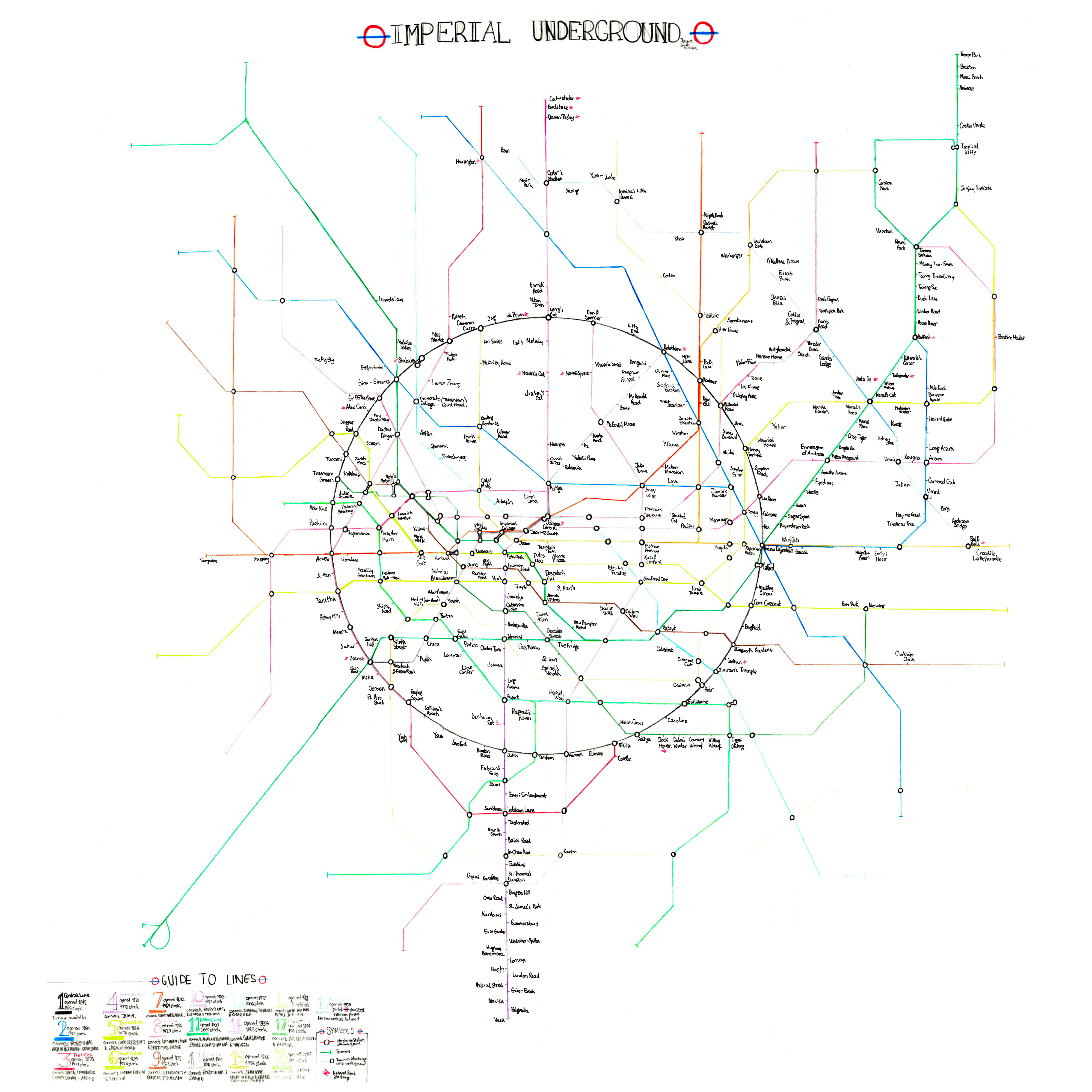
Version 2
January 2013. It wasn't long until I decided to draw Version 2. A month later, during the Christmas period (when I should have been revising), I got to work on drawing a more presentable map - using all coloured pencil. Instead of freehand drawing, all lines would be drawn with a ruler. It looks quite professional in this restoration, however this map was marred by white strips from a tippex mouse for corrections, all over the diagram. The restoration completely removes any trace of tippex. Once again, Line 16 has faded quite badly.
Speaking of Line 16, this was one of the lines that extensively changed. Previously travelling directly south from Aditya (which is now covered by today's Line E), instead it would follow the trail of the original Line 17 through to Jeroen, then run back through south St. Jacques towards the south-east. This would render Line 16, today one of the longest lines, to be even longer. The western half of the original Line 17 was excised (Line 10's western branch was a partial replacement).
Line 14 was also slightly changed, as between Dan & Spencer and Jacques Central it was far too close to Line 10. The St. Jacques system doesn't do very well with north-south trunk routes through the centre, so adjusting Line 14 was very much welcomed.
This was the first version of the map, and the first ever metro map, which I showed my friends. They seemed to be quite enthralled by the diagram, however it was ruined in appearance by all the tippex. Still, even with ow amateurish the map was, people liked looking at it, so that counts for something.
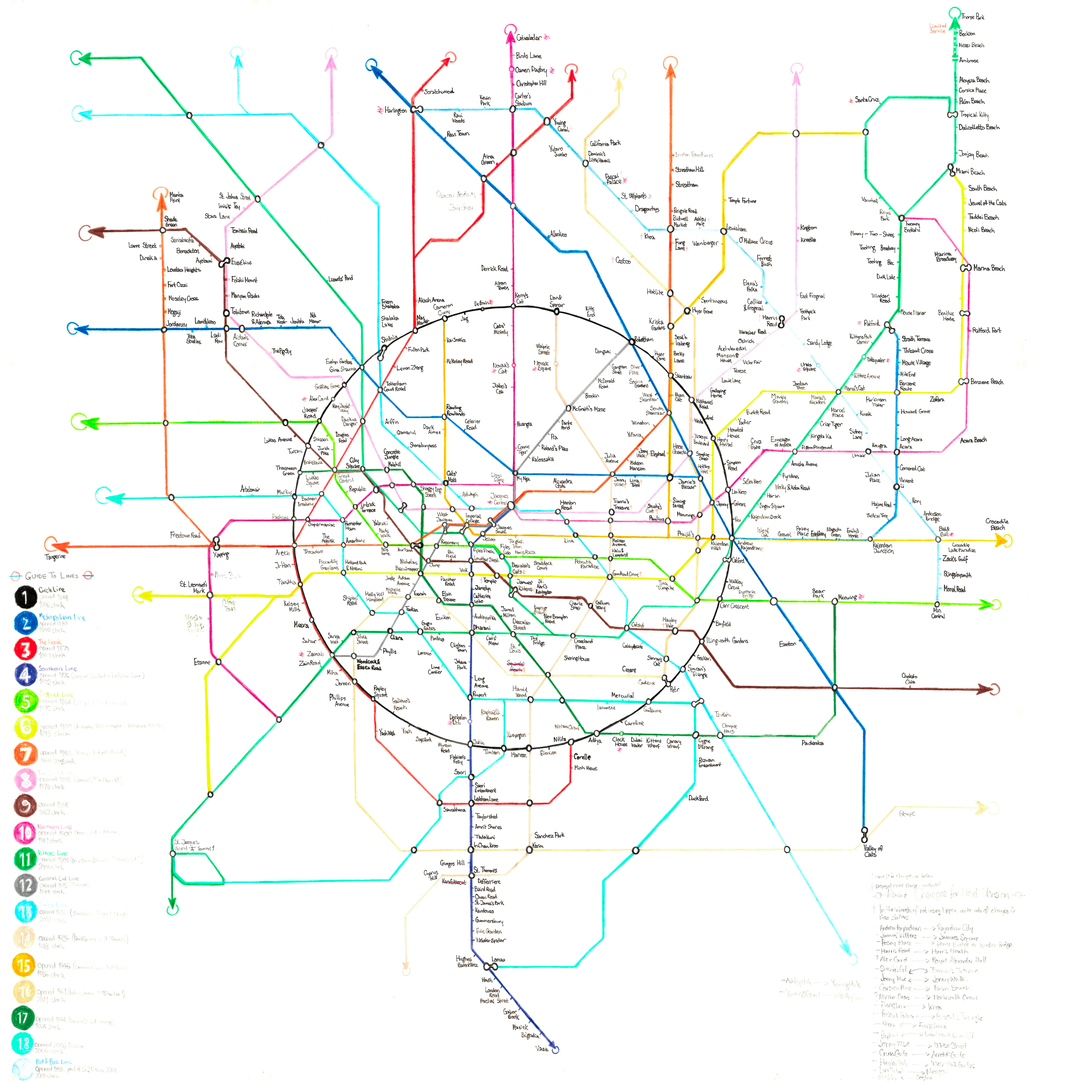
Version 3
June 2013. This version was created during a bout of chicken pox. It took me 19 years to contract the illness. Apparently, it is worse for you as an adult compared to a child (hence the reason for pox parties). However, I barely suffered. I merely felt a little tired and a relatively small number of spots appeared all over my body. This was not timed well, however - right before summer exam periods. I was advised to skip the exams, and sit the re-takes. Perhaps this was a blessing for my degree, however the retakes were in the middle of August, right through my planned Corsican holidays!
I quarantined back at home to avoid possibly infecting other students in halls. I had a lot of time on my hands now, as there wouldn't be much point in revising. There was lots I didn't like about Version 2, so I thought to create a new version of the map.
Version 3 was not very innovative, it was essentially Version 2 with slightly thicker lines (and a few changes to the line routings themselves). However, these thicker lines provided a more professional appearance. I would vow not to roll a tippex mouse anywhere near these sheets of paper.
Lines 3 and 6 would gain new branches in the north and west respectively. Line 18 would run to the airport. One change that I regret to this day, is bringing Lines 8 and 9 together in the north-east (between Tobitown and Eusebius). If it were me today, Line 9 would have run via today's Line K towards Zyxvyn.
This map has been kept as neat as possible, with no scribbles nor tippex, and I have given it a decent restoration.
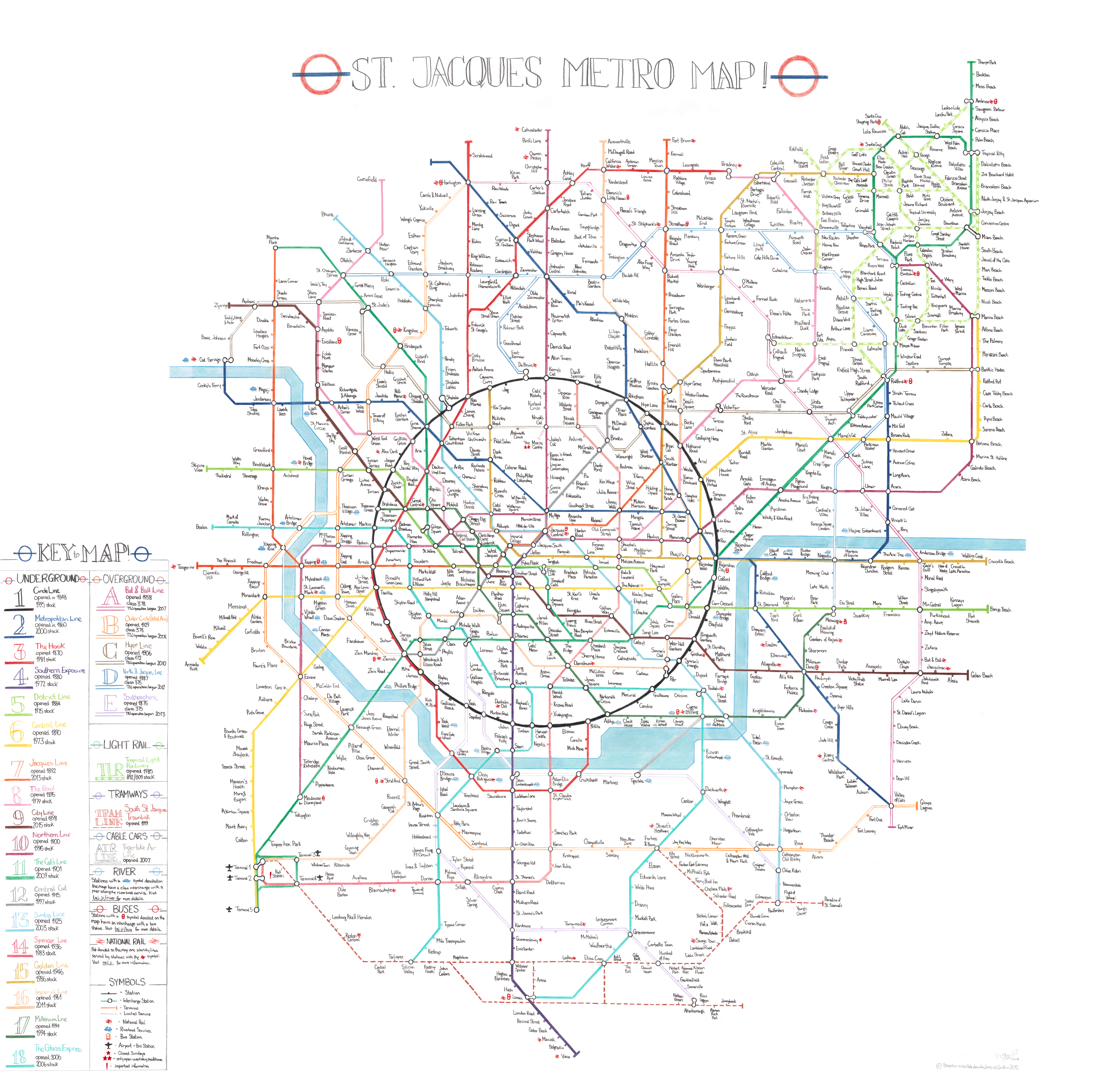
Version 4
March 2015. This version was to be my magnum opus. Even looking back now, I am still quite proud of this diagram.
Innovations
St. Jacques only had Underground metro lines. Other cities have different modes in their transport networks; London has the Underground, Overground, DLR and Trams. Paris has the Metro, the RER, Transilien and Tramways. St. Jacques was not very exciting in that sense. I desired an Overground service at the very least.
Looking at version 3, you can clearly see lines that jump out of the diagram, with the potential to eventually become part of an Overground network. The entirety of Line 19 forms part of an outer ring in the city. The ridiculous Line 16's southern section could also form part of an outer ring. Line 10 too, with its western branch, curves towards the east ultimately. Join these bits of track up, and you can form a full outer circle - and this would come to be, today's Lines G, H and J.
By this time, I had a good idea of the city above the rails. The north-eastern section of the map, dominated by Line 11's loop, was to be a sunny coastal 'satellite city', not too dissimilar to Miami, Florida. It would end up being a major centre of Greater St. Jacques, and one underground line would not be enough. It was decided to construct a light rail system here, just like the DLR in London.
In third year, I would meet an unusually large number of people. Compared to second year, there was a boom with the number of new baseball players interested in joining the Imperial Falcons, Ashley did a fantastic job in boosting the club and its numbers. Line 19, already full up, would need an extension, north-west and to the south! I was originally hesitant to change Line 19 to an Overground line (thinking that Overground stations would be deemed lesser, I wondered if the change would be unpopular with my teammates, but it's not as if they cared that much!)
I became enthralled with Dodgeball come third year too, being far more involved in the club (I did the odd sessions in the previous two years). While the baseballers didn't really do much for events, the dodgeballers were more willing to party and attend the sports nights at the Union on Wednesday evenings, so I spent more time with them. As always, as I met more people, I would add more sections - and reserved the north part of the city for dodgeballers (though the south at the time needed development). The lines in the area would not be enough, so a new line was devised to accommodate the Imperial Wolverines. (Indeed two people from dodgeball already had stations marked in pencil on Version 3).
I also wanted to revive the river for the next version of the map - a bold choice and to the dismay of my light blue-coloured pencils!
These were a lot of major changes to incorporate into a brand new map. First, it was decided to upgrade the size of the map from 3xA3 and 6xA4 to 3xA2 and 6xA3. I would also need a larger circle; a huge serving dish owned by my father would do the trick. In October 2014, in my wonderful house share with the amazing Hyer twins, I would take over the living room desk to sketch my plans.

Low quality photo of the draft of Version 4, soon after completion. Notice the lack of trams and the lack of today's Line M, which made it to version 4. Also intriguing is the continuation of Line 18 to Pietra Airport instead of Line 14.
Here is the sketch. It's not a very good quality photo, and there isn't any point scanning this sketch and restoring it. Since this photo, attempts were made to flesh out a tram system, and there are a lot of scribbles on the pages at present to experiment with the diagram ready for the neatened version 4. You can see the two Overground lines forming the outer loop, one new overground line through the northern edge of the city centre (which really should have become an Overground line), and the dodgeballers' new Overground line in the north. The southern Overground line (today's Line M) was not drawn at the time that this picture was taken, it was later sketched out in pencil.
University took over. Baseball brought its dramas, Dodgeball was always lively, and though I dialled down my partying and focused more on studies (I had a disastrous second year, failing three exams). Be At One was only a few blocks away, so the Hyers and I took advantage of the two-for-one cocktail offer for students. It was not until February 2015 when I began to start drawing Version 4 properly. One night, I felt particularly inspired. Tracing the map out with light pencils first, I eventually draw the circle and all the lines within, and was very, very happy with the final result. Only gradually would I start drawing the rest of the map.
March 2015 wasn't a great time in my life. University was almost over for me. I had been downgraded from a Masters to a Bachelors degree. I had foolishly chosen not to think about my career; my intention was to continue my studies. Whilst my friends were travelling across London and even the entire country to attend the career days arranged by large corporations, I sat there twiddling my thumbs, playing baseball and drawing maps. However a timely reality dawned on me. I was out of uni with absolutely no secure plans. The bliss of student life would abruptly end.
The anxiety of baseball did not help. I only barely just made the team for the Imperial Falcons for the important Autumn University Championships. I really wanted to play one last time with the lads, showing off my new cleats and jersey. Alas, I would end up being cut from the team, and I was devastated. I had a mental breakdown - enough so to go home. I however had a 20%-finished map on my desk to calm my nerves and bring me gently to my reality.
Slowly, the rest of the map would be drawn out, using the same method of initial traces with pencil, to ensure that no mistakes were made whilst drawing the lines. It proved to be a huge stress releaser. At this time, I vowed to study my hardest, to secure a 2:1 degree, as I was in danger of finishing with a 2:2 if I didn't have a very good exam season. After a day of hard revision, drawing maps would relieve the tension and anxiety. I would, at times, map until the early hours of the morning. The Hyers would always be checking up on me, curious with the map's progress.
The map would be completed in April 2015, after two months of work. However, I had no intention to release the map until after exam period had finished.
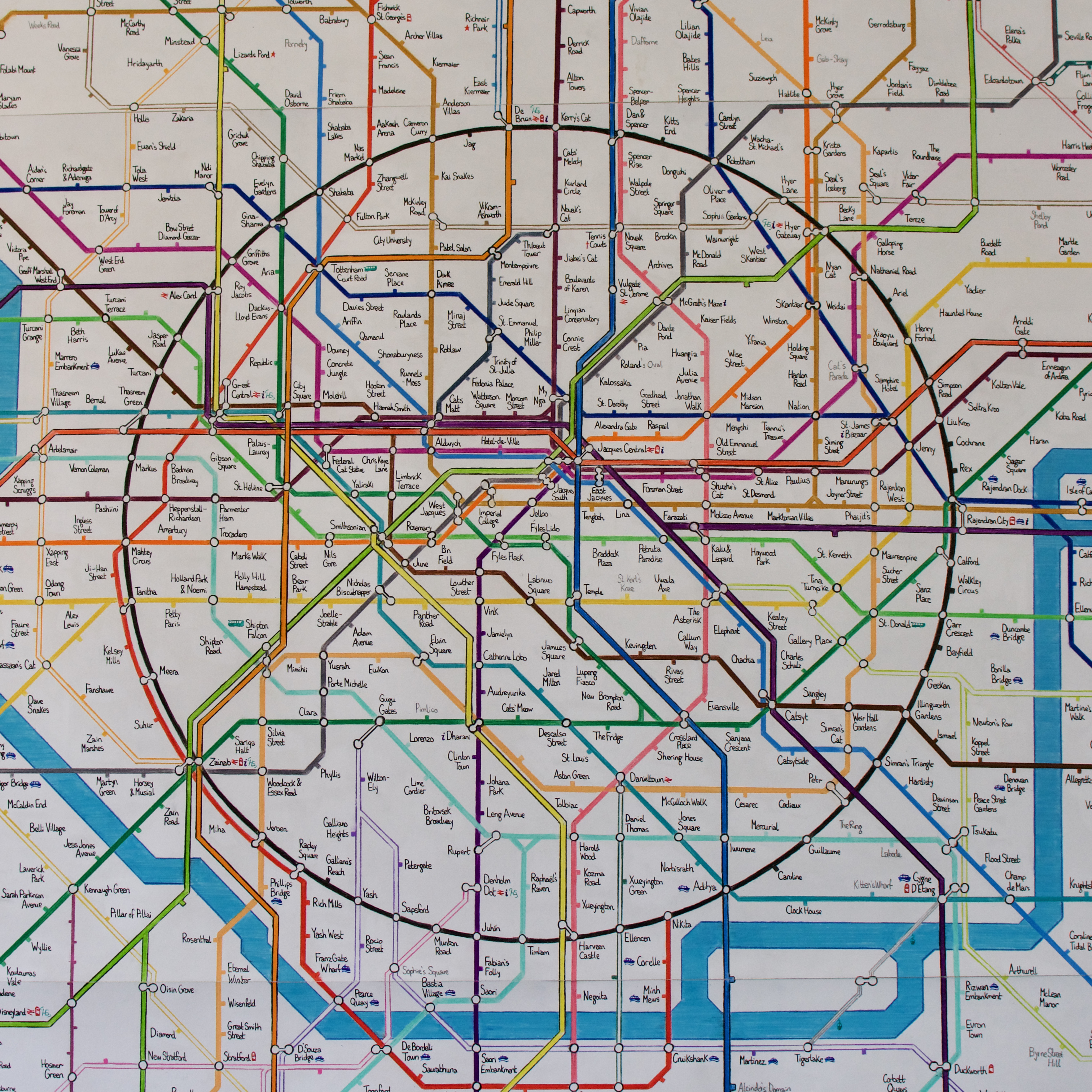
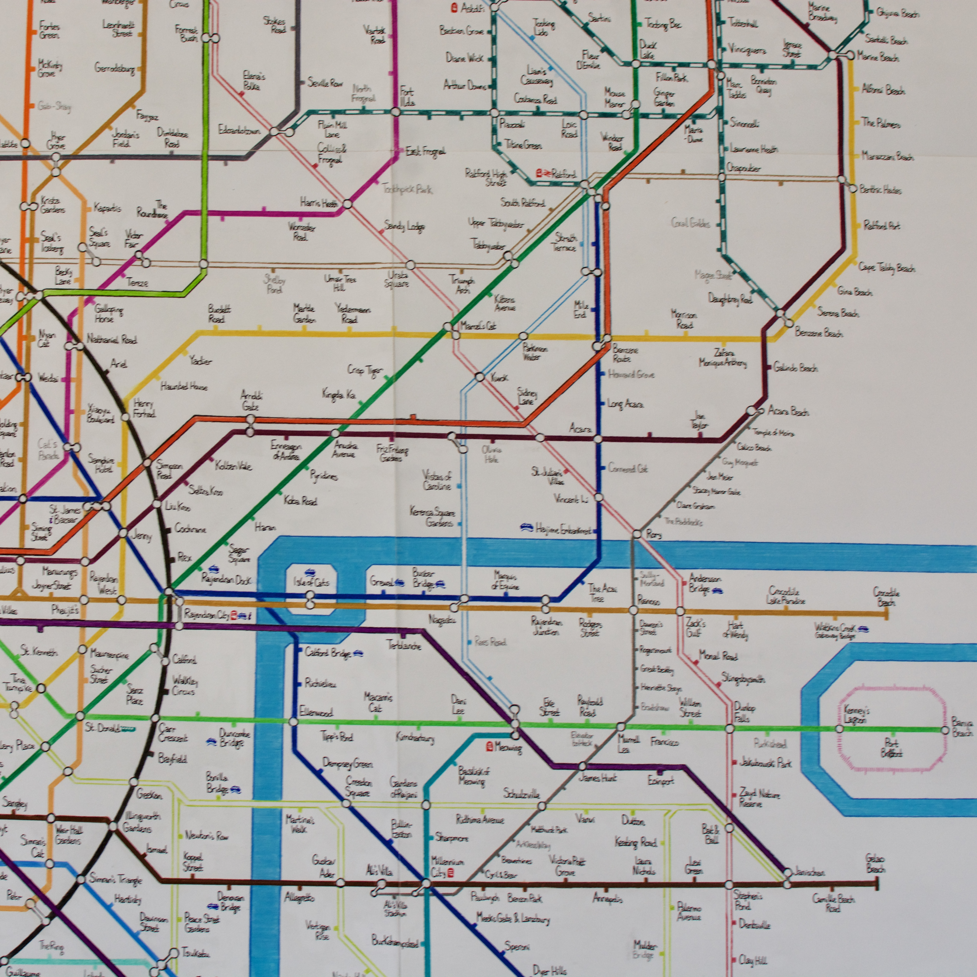
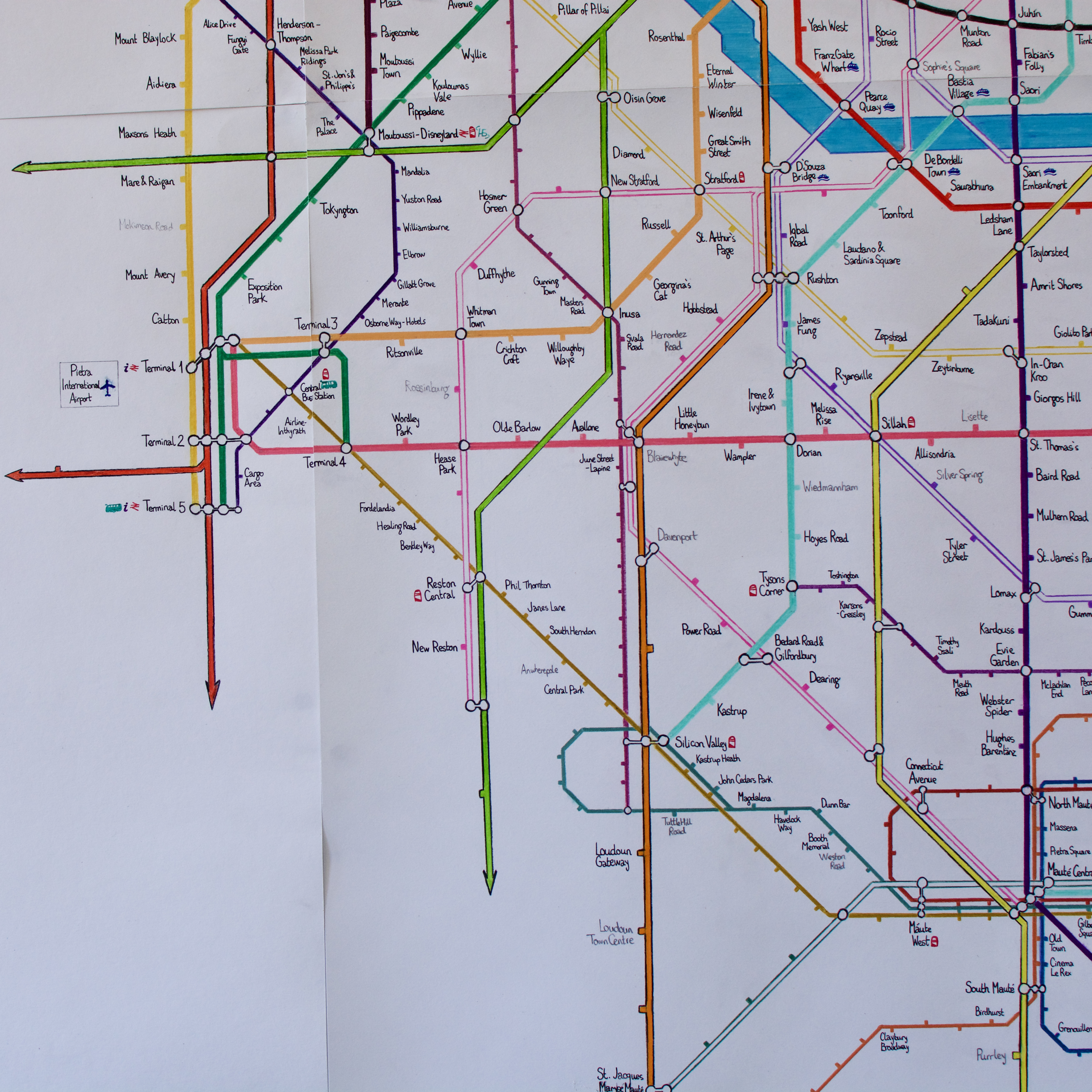
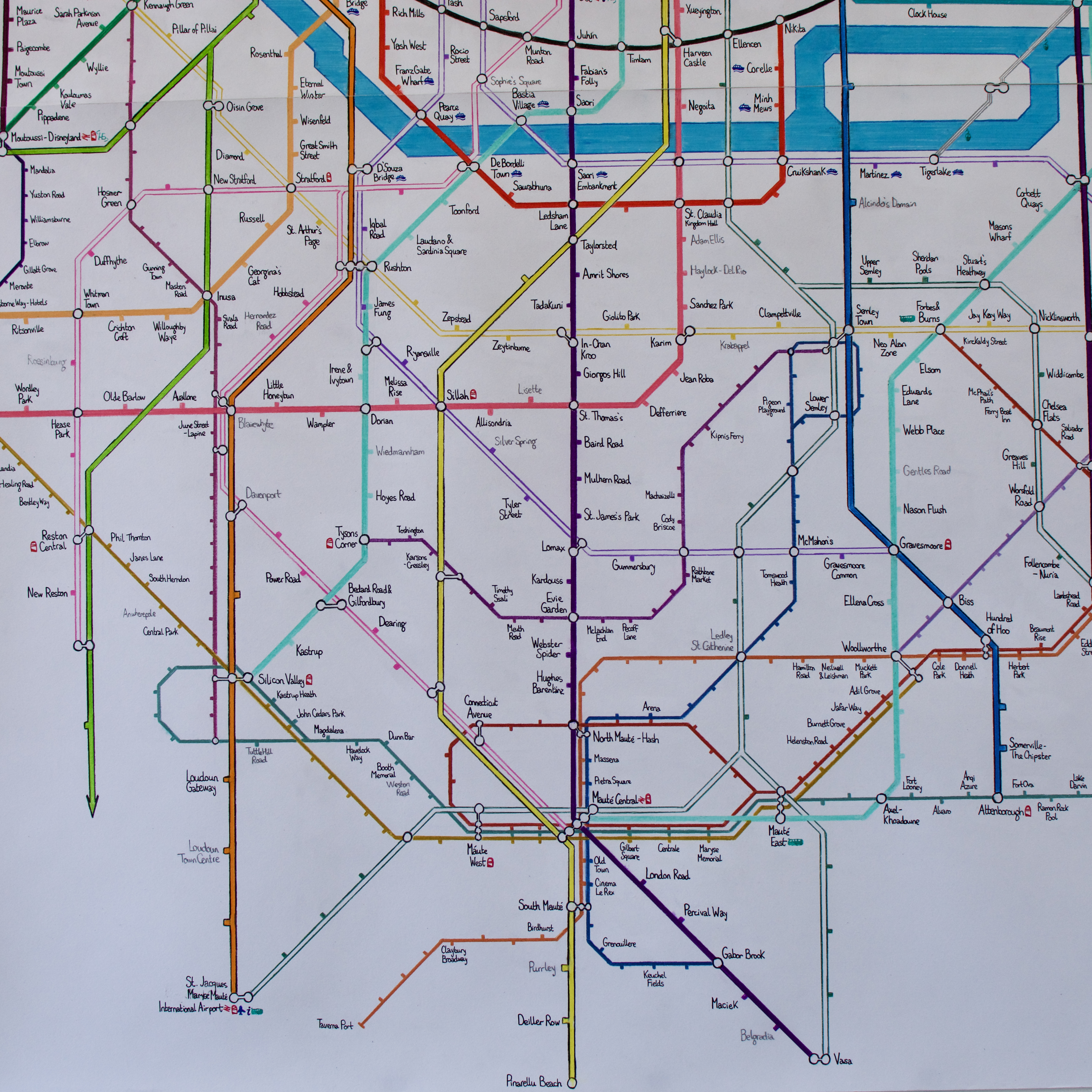
The St. Jacques Map had always been intended to represent everyone I met at university. However, even with all the people I had met, it was still a relatively empty map. This is what the map looked like upon its initial completion. It looks quite barren, especially compared to today's diagram. South St. Jacques was a complete ghost town. The map had to be filled out somehow, certainly for its intended release. I decided to include two new groups of people; the south-west would be adorned with stations for some of my best friends from secondary school, due to the fact that I would often go back to Potters Bar for our regular Old Owenian meetups at the pub, organised by good ol' Peter - stations would also be given to those, while I wasn't close with them during school, who often showed up to these meet ups. People in Corsica also received their stations, to boost up the numbers.
Here I was thinking that 'adult life is going to so mundane and boring. I'll have a job which will tire me out, and I will no longer have a semblance of a social life. At least, nowhere near as busy as my university days'. Oh, but how wrong I was.
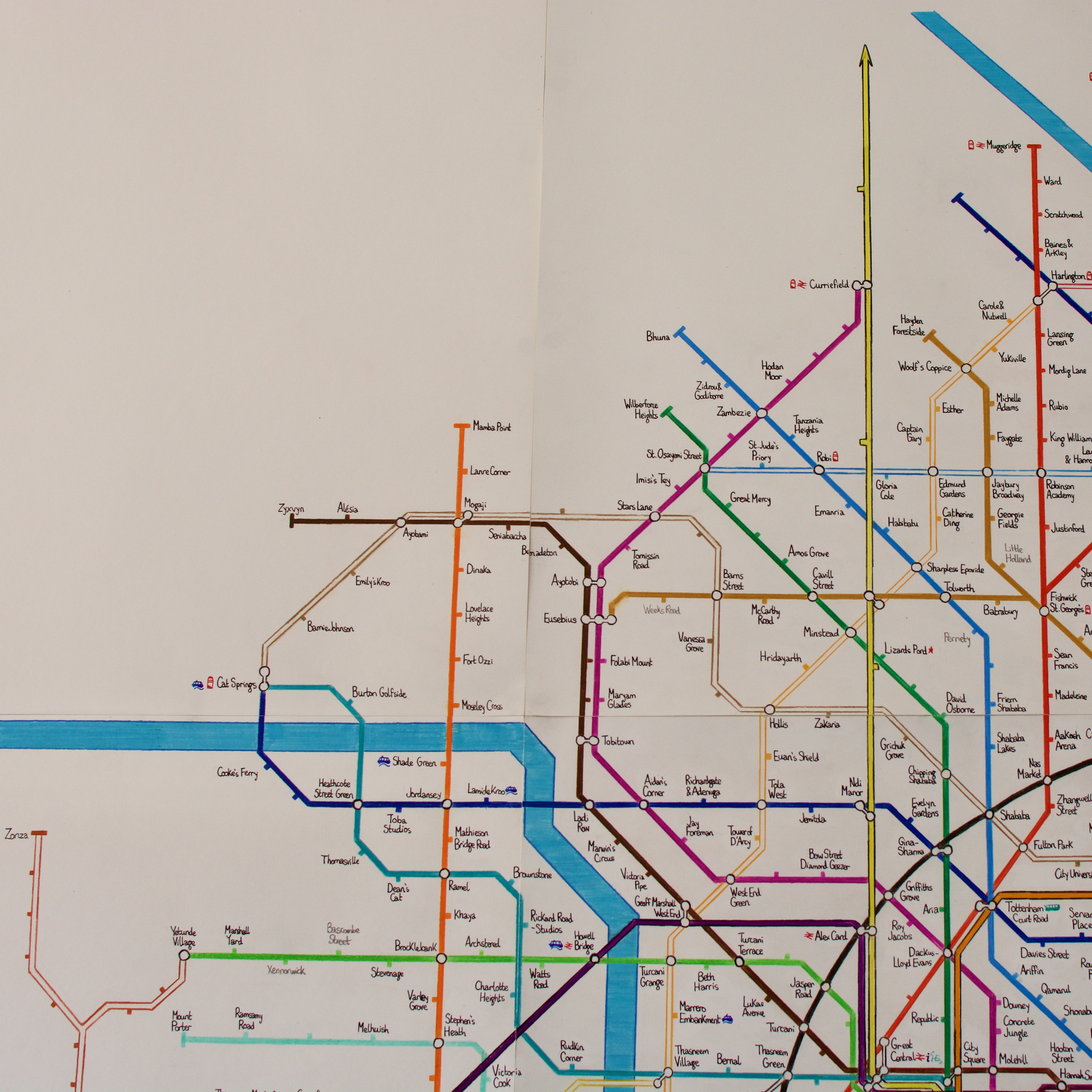
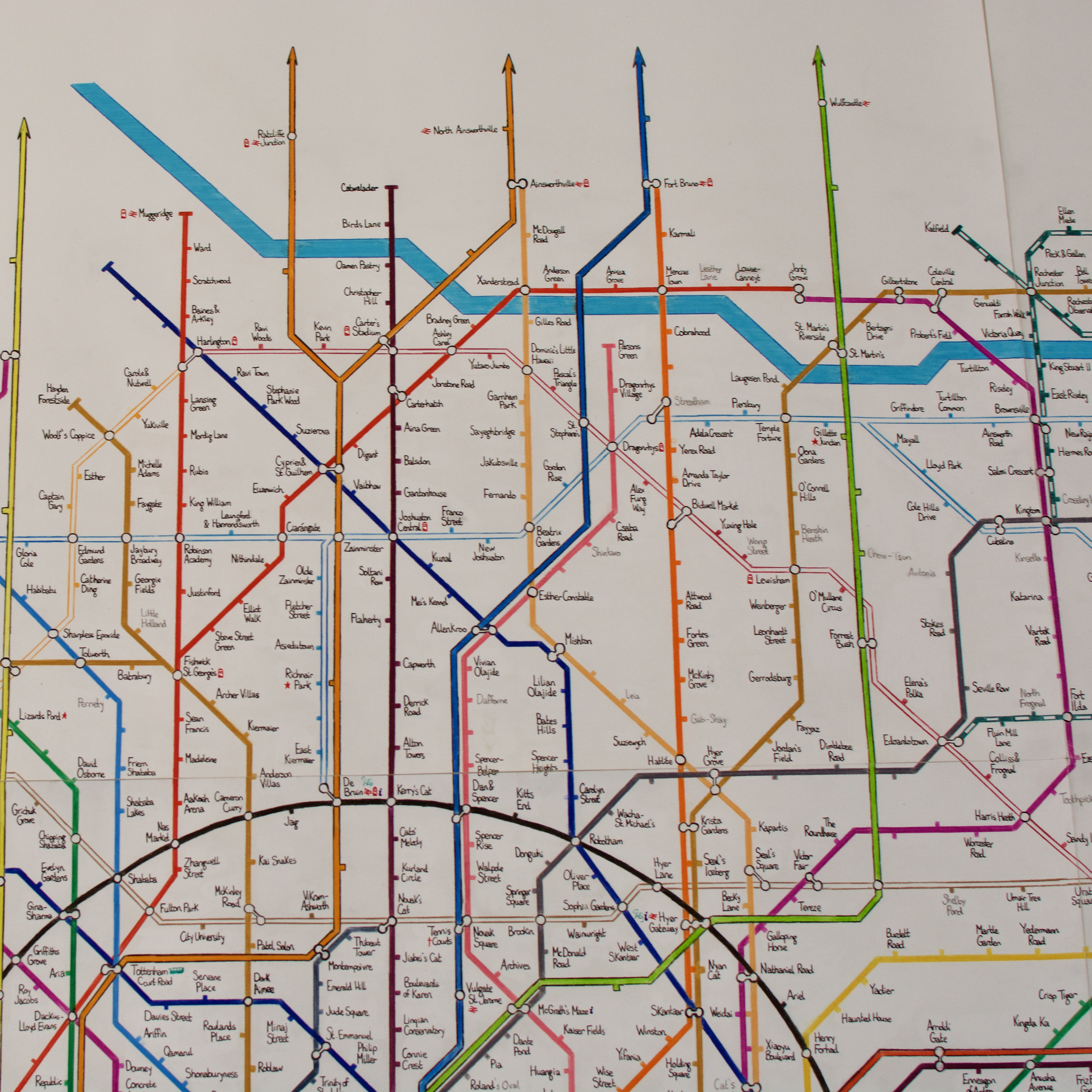
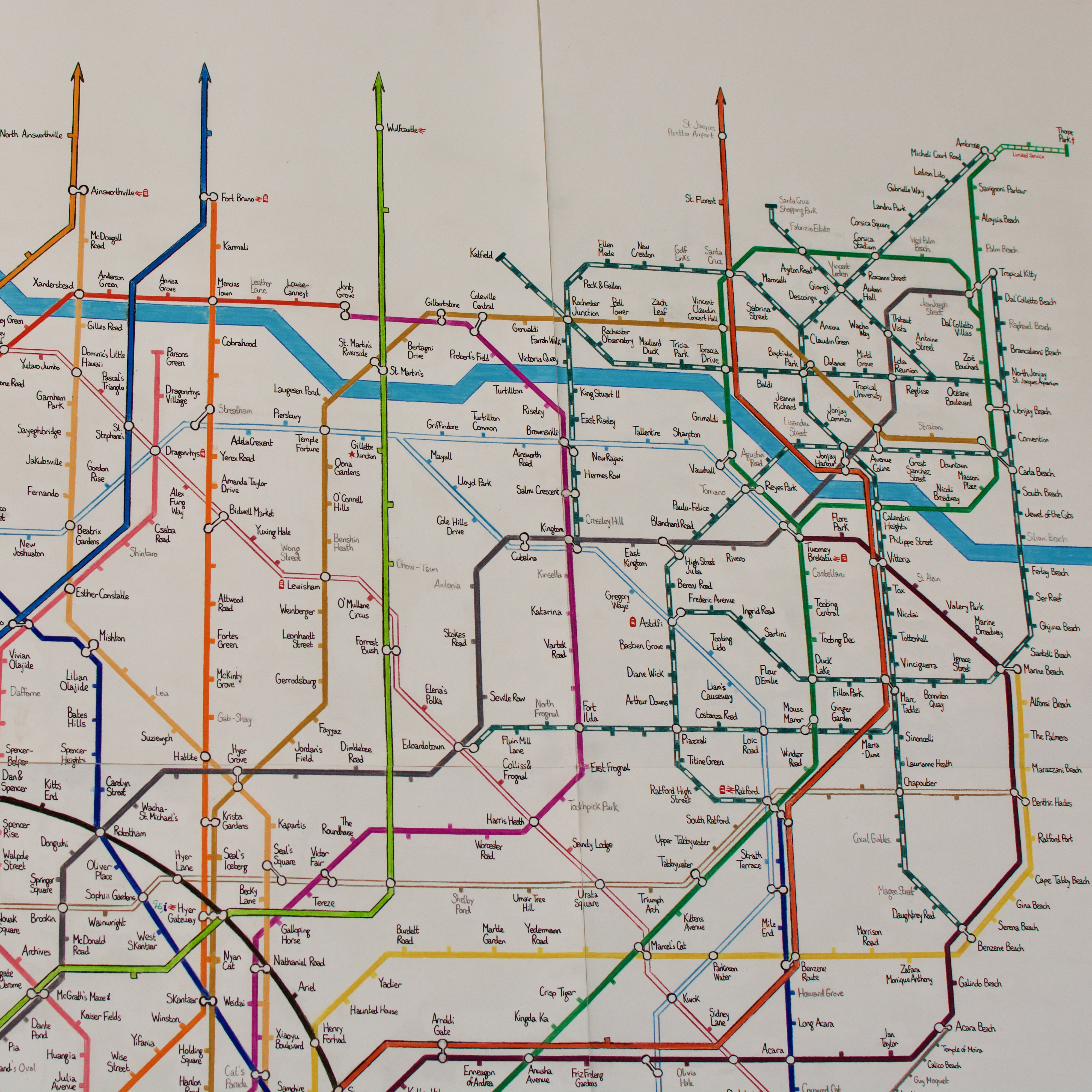
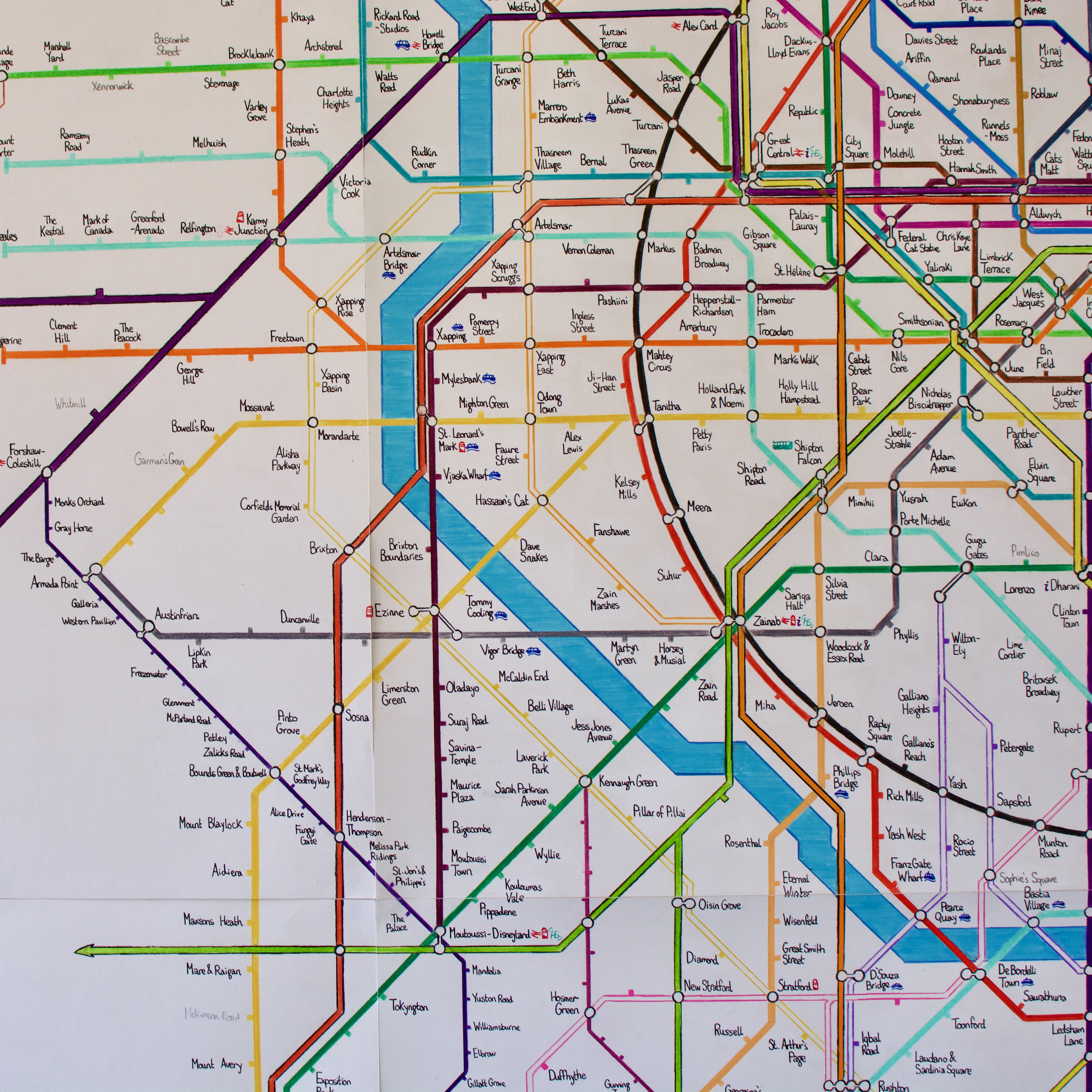
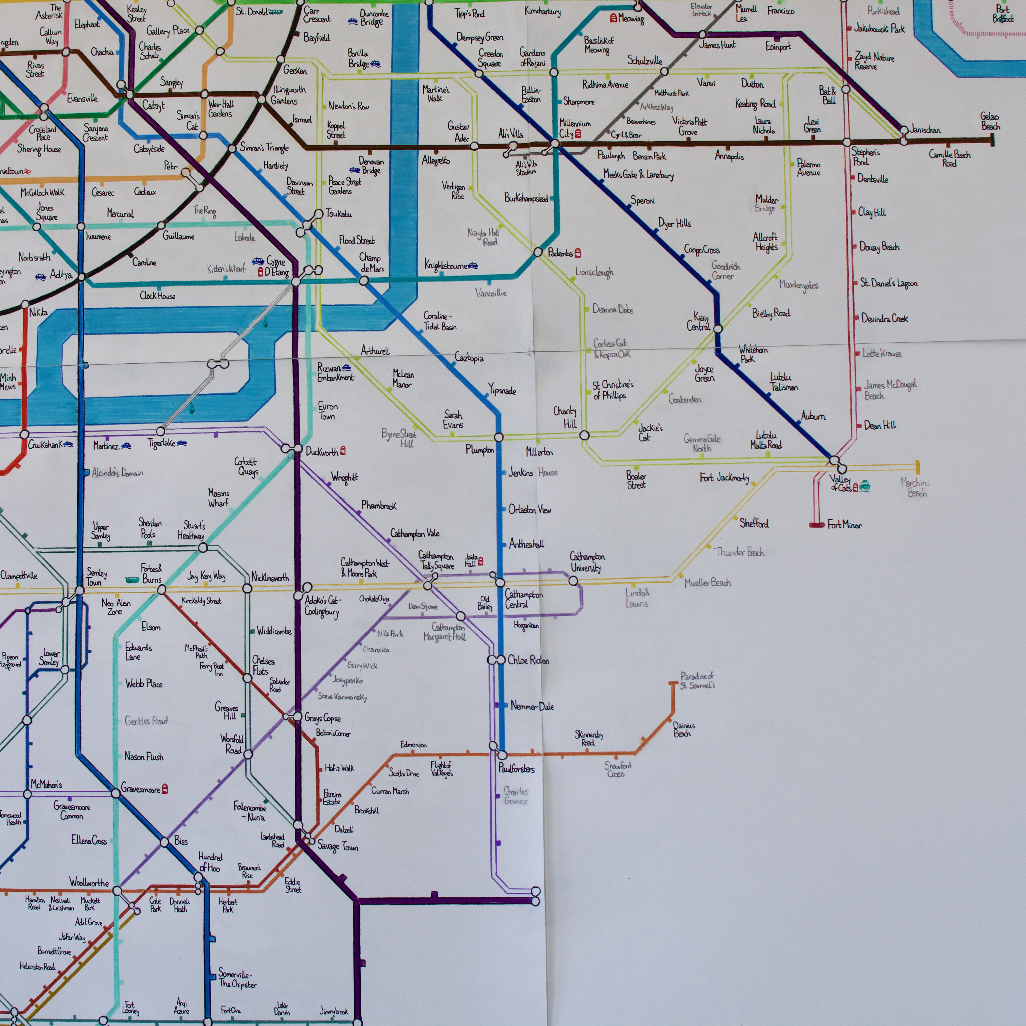
This map is now obsolete, but became really quite full up by the time it was replaced by the current version. I have painstakingly given this map a beautiful restoration (perhaps even better than the current version's translation to a full image!) - it took over a week to restore this map!
If you wish to see the original photos of the map, as well as the key - see below.
 |
 |
 |
 |
 |
 |
 |
 |
 |