A selection of miscellaneous nonsense about the ZTA map.
Map Stats and Fun Facts | Line Summaries | Teams Not on the Map | Expanding the Map and Future Proofing | A Detour Towards London Property | The City Above and Arrondissements
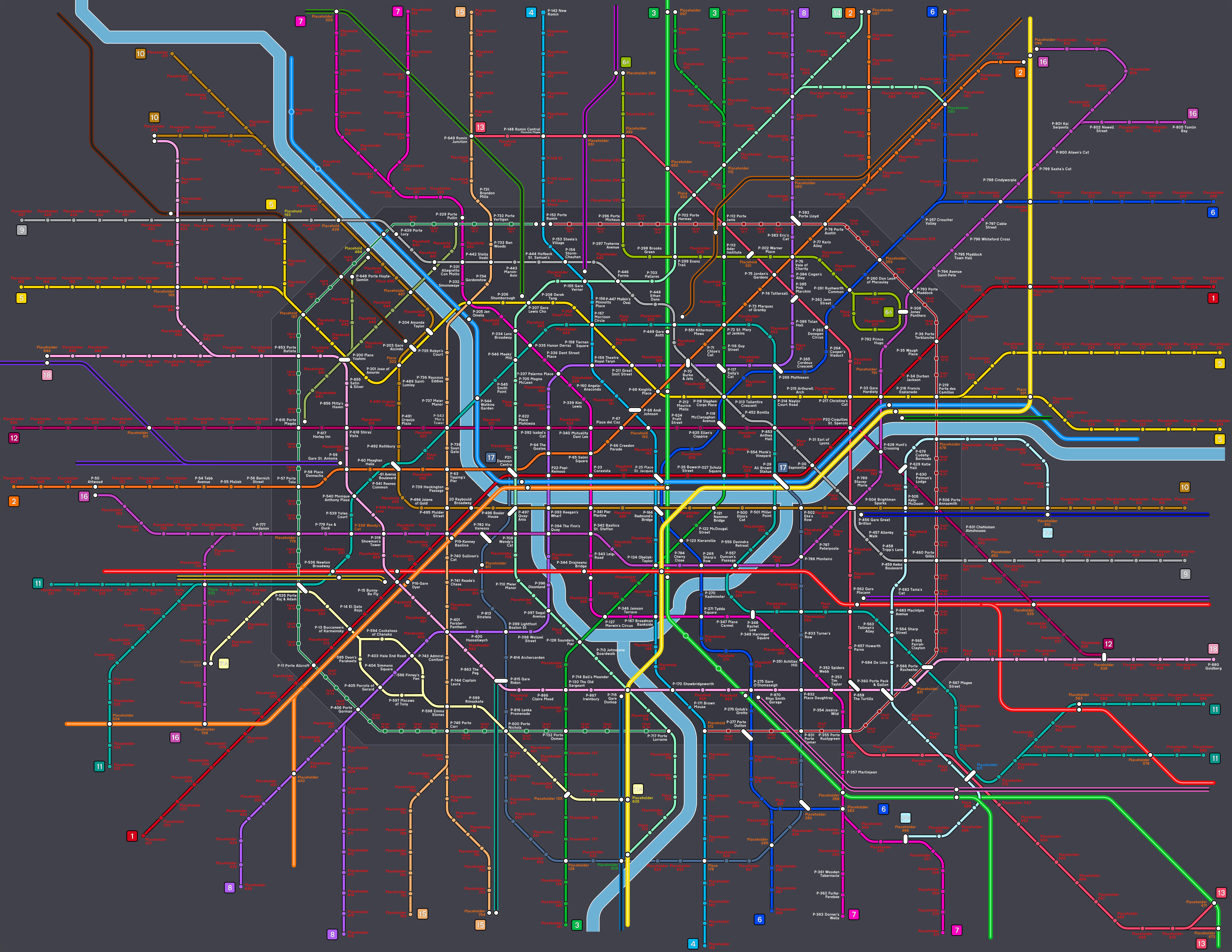
The map during its development phase, with lots of alternative names and a few different line colours (such as Line 8 and 16 being practically the same colour. Good luck to those travelling from The Finn's Quay). Click to enlarge.
The map was in development since mid-2022, even before the first sketches, where I compiled a list of names that could be added onto the map. This first list had 303 softballers in total.
The original capacity of the map was suggested to be 600 or 700 (in both cases I would have run out of space by V2!)
Lines were not to extend more than 10 stations beyond the centre, however this has been broken numerous times.
There are 394 stations in Zone 1 (excluding the Tram Stops). Of those, 378 have been filled. 16 remain.
There are 247 Raiders on the map, past and present. This represents about 28% of the filled stations. The proportion is slowly decreasing, in Version 1 the ratio of Raiders was about 37% (189 out of 510), and this went down to 30% for Version 2 (211 out of 682).
Of the Raiders, 121 are present Raiders (in 2025), the remaining 126 are former Raiders.
171 of the stations in Zone 1 are named after Raiders, unsurprisingly the most significant proportion. This is 43% of the Zone 1 stations available.
For the most part, the colours of lines match the Raiders team they represent.
The colours of Line 4 and Line 13 were chosen for a particular reason. This was clearly defined in my initial plan for the map back in 2022.
There are 261 people who have played baseball on the map. 52 of these people have also played softball, hence get stations instead of tram stops.
371 softballers also have stations/tram stops on the St. Jacques Map (you can see if you’re part of this group by looking at the index of the ZTA map).
At present, only one person on the map has more than one station. Hard to decide who gets the huge interchange in south-east Zafarnia. There’s actually two people, but who’s counting?
There are 281 people on the map who played in NSL in 2025: 64 in NSL1, 86 in NSL2 and 131 in NSL3.
There are 450 people on the map who played LSL in 2025: 85 in Div 1, 62 in Div 2, 84 in Div 3, 71 in Div 4, 47 in Div 5 and 101 in Div 6.
To my knowledge, of the softballers on the map, 708 are still playing, leaving 186 that no longer play (this mostly consists of ex-Raiders).
Only one team in the entire LSL has no representation on the map. Unfortunately, the Cheetahs is this team, which played in the same division as Raiders Blue for two years. (I would have added the team’s regular pitcher for sure, but I don’t know his name). I suppose they don’t make themselves known at the LSL events.
Two NSL teams have no Zafarnia representatives. Tempest II and the Globo Gym Purple Cobras, who were both in NSL 3 ironically, so we did play them. I was considering adding a player on the map as I was so impressed by her pitching, ultimately I can’t really add anyone I have not spoken to directly.
Line 16 was originally lilac, however it was too close to the colour of Line 8, so was changed to brown.
Line 12A was a very late addition, originally in a very similar colour to Line 6A before it was changed to blue-gray.
The terminus stations of the Express and Rail lines are named after players in the MLB. The original plan, however, was to name these after the Imperial Falcons that did not make it to Tramway T2. I changed my mind and placed them all on Tramway T9 instead.
After the Raiders, in order of numbers, Thames Valley are next for most represented, then the Salty Seamen, then the Fuzzy Ducks. For teams I don't regularly play for, the team with the most is currently Mouse Rat.
The lines can be summarised as follows:
Line 1: Mouse Rat – Raiders Red – MI6 – Mescalitos
Line 2: Base Jumpers – Asteroids – Raiders Orange
Line 3: Raiders Green – Dazzlers
Line 4: Green Sox/Storm – Raiders Blue – The Mob
Line 5: Rattlesnakes – Swamp Monsters – Battitude – Bat to the Future – Southern Stormers
Line 6: Diamond Dogs – B-Sides – Thames Valley
Line 6A: fOXes – Reading
Line 7: Ireland – Warriors – Storm – SPAM – Thames Valley
Line 8: Raiders Indigo – Buccaneers – Parrots – Cardiff
Line 9: Mezcalitos Ninos – Salty Seamen – Oblivion – Sunday Softball
Line 10: Bracknell – Base Bandits – Breaking Bats – Raiders Gold – Maidenhead
Line 11: Fuzzy Ducks – Furies – Thick Boys – Travelling Dodgers
Line 11A: Bat Intentions – Buccaneers – Parrots – Banditos
Line 12: Fly Ballers – Base Jam
Line 12A: Beavers
Line 13: Green Sox/Storm – KKs – The Mafia
Line 13A: BBG Muppets – Oblivion – LNZ
Line 14: Bangers & Smash – Blitz – Golden Sombreros
Line 15: Private Is – Raiders Gold – Buccaneers – Pirates
Line 16: High Voltage – Base Invaders – Coyotes – Panthers
Line 17: Game of Throws – Blitz – BASU
Line 18: Bristol – Knights – Beavers – Raiders Pink – Meteors Red/Purple
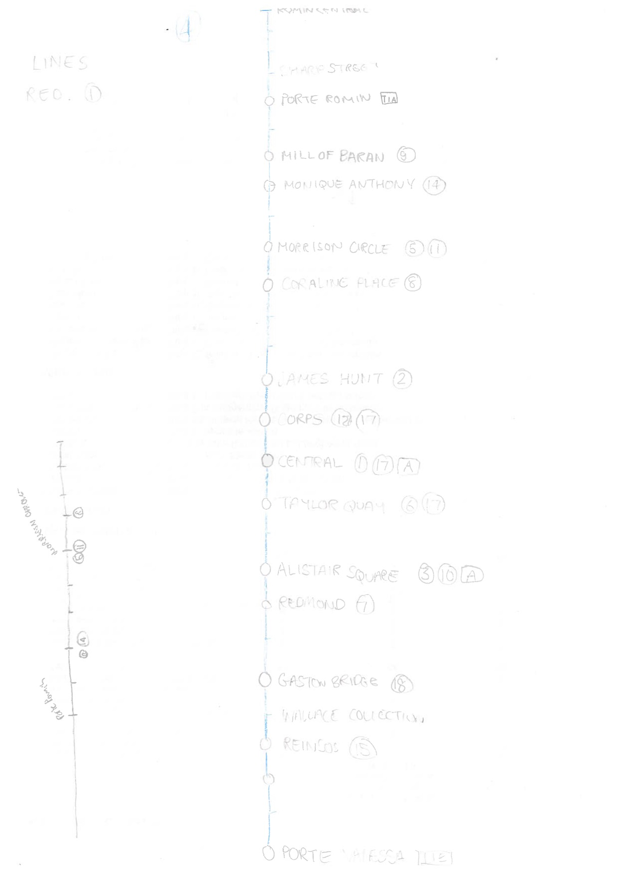
Line 4 appears to be the first line that I started to fill up. Click to enlarge.
Below is a list of remaining LSL and NSL teams that do not have a dedicated section or area on the map.
It may be the case that there’s lots of players from a team scattered around the map, however these players will have been placed on sections on other teams they play for.
It may also be the case that I simply don’t know enough people (well enough or on a name basis) to create a dedicated area for that team.
Of the teams in the LSL and NSL, the following teams are not shown in the index:
Meteors Black (Div 1)
There are several stations for Meteors Black players, though they are scattered across the map. It’s worth looking at the other teams you play for to find your station. They may potentially be consolidated into a single area eventually. Quite honestly, I should have included Meteors Back in the index as most of the team is on the map, and I have the Naturals in the index of teams which is in the same predicament. Ultimately, I’ve played against the Naturals but never against Meteors Black. Also, 72 is a nice round number; 73 isn’t. Meteors Black may make the index in V4, watch this space. (10)
Soft Boiled (Div 2)
I only know two people on the team well. They are seen within the Breaking Bats section, on Line 15. (2)
Cheetahs (Div 3)
I don’t know anyone from the team by name. (0)
Thundercats (Div 4)
There are a number of Thundercats present on the map, scattered about – not confined to a single area or section of line (though there is a small area brewing at present around Line 13A). (5)
Bonk Squad (Div 5)
I only know one player from this team. (1)
Badgers (Div 5)
I only know one player from this team. As he happens to be a BASU umpire he has been placed in the BASU zone. (1)
Tecumsehs (Div 6)
There are a few Tecumsehs present on the map, which can be found on the end of Line 9 or within the Blitz section. (4)
H2O (NSL 1)
There’s a few stations for H2O players, most have found themselves on Line 15 (either the northern or southern end). (4)
Windsor Knights (NSL 1)
I only know two players, they also play for the Fuzzy Ducks, so are found on Line 11. (2)
Pioneers (NSL 1)
Several stations are scattered across the map, found in sections for other teams they play for. (8)
Chromies (NSL 1)
A large part of the team play for London teams, mostly Mescalitos, but there are others from MI6, Mouse Rat and Fuzzy Ducks. Best look at those sections instead. (9)
Tigers (NSL 1)
Of those I know who play for this team, most also play for Reading. (4)
Spittin' Camels (NSL 1)
I only know one player from this team. (1)
Honey Badgers (NSL 1)
I only know one player from this team. (1)
Tempest (NSL 1)
I did initially have a preliminary mini section for Tempest at the northern extremity of Line 3, but one of those players has since left the team. Others are scattered around the map. (6)
Meerkats (NSL 2)
There is a mini-Manchester section at the southeastern end of Line 13, which is shared with the Mavericks. (2)
Blue Steel (NSL 2)
I don’t know this team very well, there is the odd station on the map here and there but no dedicated area. (2)
Terriers (NSL 2)
There is a very small section at the southern end of Line 15, though the London-based Terriers are found alongside their respective LSL teams on the map. (4)
Mavericks (NSL 2)
There is a mini-Manchester section at the southeastern end of Line 13, which is shared with the Meerkats. (2)
Shafting (NSL 2)
I only know a couple of players, including one who played with the Panthers at Prague in 2023, and sold me my beloved Anarchy bat. (2)
MK Diamonds (NSL 3)
The Coventry Blitz section could eventually be shared with the MK Diamonds, that’s my intention for V4. (2)
Tempest II (NSL 3)
I did initially have a preliminary mini section for Tempest at the northern extremity of Line 3, but one of those players has since left the team. Others are scattered around the map. (7)
Manchester Dodgers (NSL 3)
The Manchester Dodgers have a lot of players from London and Windsor, including some Raiders! (There were five Raiders playing for the Dodgers at NSL this year). Most of the players are from London so can be found in their respective LSL teams. (8)
Globo Gym Purple Cobras (NSL 3)
I don’t know any players on this team. (0)
Sharks (NSL 3)
I only know a couple of players from this team by name. One is contentious as to if he plays as I always thought he was a Travelling Dodger... (2, perhaps only 1)
Spitting Camels II (NSL 3)
I only knew one player from this team. (1)
A development sketch before it was finalised. We've come a long way since.
When created, the map had space for just over 900 players. This was deemed enough at the time, and I stated that the map was future-proofed to a point. One and a half years later, the total number of players is now 894. Pretty much full capacity if I had not implemented some extensions.
From Version 1 to Version 2, extensions were very minor. The 6A and the 13A were extended two stops. The total capacity was brought up to 918. Lots of space available, there wasn’t much of a need for expansion, but I’d have to think about it for Version 3, the current iteration.
There would be a point where space would be exhausted, but I didn’t think it would come this soon. For Version 2, a list of potential expansions without significantly altering the overall map was considered.
Firstly, one or two-station expansions at both ends of each line was a possibility, overall enlarging the map. This has not been implemented for V3, but for V4, this will have to be a possibility. I quite like how spaced the stations are at the moment, trying to cram more stations onto existing lines would make the map less aesthetically pleasing.
The list of extensions were as follows (with commentary to what was eventually implemented for V3):
Line 1 could be extended a couple of stops south-westwards. This was implemented, adding 3 more stops.
Line 2 could be extended a few more stops north-eastwards (towards the T6 Tramway). The extension was implemented by redesigning the awkward eastern end of Line 16, however it does not reach Tramway T6. This added 3 new stations.
Line 2 could be extended a few more stops north-eastwards (towards the T6 Tramway). The extension was implemented by redesigning the awkward eastern end of Line 16, however it does not reach Tramway T6. This added 3 new stations.
Line 5 could be extended north, up to High Tower and the Tramway T7 terminus. This was an obvious one to add, with space for 6 new stations.
Line 6A could branch off south-east from the loop, running from Jones’ Panthers towards Porte Terblanche, interchanging with both branches of Line 5, crossing the river to reach Line 13A and terminating on the Line 10/R interchange. There is scope to run this to the Line 12/D interchange too. Indeed, I have run it all the way down to Line 12. This allowed 8 more stops and gave more space for Reading and fOXes players.
Line 7/13A re-working: from Bevenzed, Line 13A takes over the Hashimborough branch, with Line 7 continuing eastwards instead to the Line B and Tramway T5 interchange. Line 13A could get a small branch too for more capacity. This proposed change was altered greatly, as the B-Sides were now in contention for more space. Instead, the Line 6 stub to Martinjean became a more fleshed out branch. Line 7 remained unchanged, and Line 13A would be extended to the Line B/Tramway T5 terminus instead. This allowed for 9 new stops, and the Thames Valley/B-Sides/LNZ can now be considered its own complex.
Line 8 could extend further south-westwards. This was implemented. 3 more stops.
Line 10 could extend further north-westwards towards Line V. Implemented. 3 more stops, more space for Bracknell.
Line 11 could extend further south-westwards towards Tramway T9. Added. 2 stops, why not.
Line 11A could extend at both ends, towards the west (Line E/Tramway T9 interchange) and on the east end, taking over the Line 6 branch to Martinjean. It didn’t extend quite so much as initially planned, not quite reaching the interchange to the west. Due to the change of plans for Line 6, the line was extended just to The Boey on Line 6 instead. Still, 8 new stations, not bad going.
Line 12 could extend further south-eastwards towards the Line B/T5 interchange. Done, adds 2 stations.
Line 12A could extend south-westwards from Porte Madga and northwards towards New Romin. This was not implemented.
Line 13 could extend further north-westwards a couple of stops. This was not implemented either.
Line 14 could extend over the path of Tramway T8. The line was instead extended a few stops south, adding 4 new stations (less of a cut to Tramway T8, which still remains empty).
Line 18 could extend westwards. Indeed this has happened. 5 stations have been added.
56 new stops added in total, more stations were also added to the express and rail lines for more capacity, and the odd Metro station was slotted here and there to boost numbers. Now, the capacity is up to 1,000. Still, just 106 spots remain at present, and if the 2026 season is as busy as this year’s, I’d run out of space completely. V4 is going to look markedly different from V3, and quite a bit larger.
I’d want to avoid expanding the existing lines by one or two stops but it may have to finally be implemented. There aren’t too many viable extensions now of existing lines apart from the proposed changes to Lines 12A and 13.
A Zone 4 will certainly be included for Version 4, where the express lines are further developed. This may also continue onto a Zone 5 for some real future-proofing. This means more of the express and rail lines can be displayed. Looking at the Ile de France Mobilites map, lots and lots of stations can be added, with potential for new zones, though the metro network will look a little smaller in comparison.
The Paris Metro map will have new additions over the years with new metro lines in development. The Grand Paris Express is under construction, adding five new lines to the network. These lines will run outside of Paris itself, connecting the suburbs more efficiently than before, serving many major interchange points (such as La Defense and Charles de Gaulle airport). Think of it as Paris’ own Overground system.
The jewel of the Grand Paris Express will be Line 15, opening for passenger service soon. This is a loop just outside of the city, in Paris’ Zone 2, where it will connect all of the Metro, RER and Transilien lines, allowing passengers to make journeys around Paris without having to go into the centre. It is Paris’ own version of the London Overground, specifically the loop made between the Mildmay and Windrush lines from Clapham Junction – Highbury & Islington – Clapham Junction. Just completely hi-tech and operated with driverless trains. To think if we had better funding for public transport, not just in London, we could build useful networks across all major cities in the country, however we can’t even get HS2 right. Broken Britain.
A great idea for a line, however… in ZTA’s case, it won’t really add any new stations to the map. Line 15 only adds two new stations to the Paris Metro map. Not much for capacity.
The answer comes in the lines of the other four, less acclaimed lines, 16-19. These lines are brand new, many serving poorly connected parts of Greater Paris, with lots more new stations. This is the key. For Zafarnia, lines could connect to places like Corpsville, other major interchanges, Farnham Airport and a new airport elsewhere in the city.
These significant extensions could future proof the map like never before (and perhaps the number of people I meet may slow down). The charm of having a Zones 1-3 map would be lost, however, but this community is just so ginormous.
The St. Jacques Metro Map mirrors the property crisis in London. Back in the day, there was tons of space on the map, and property wasn’t insanely expensive in London as it is now. As the city and map have developed over the years, more and more people have arrived. Station space is sparse – almost no chance in the centre (I very rarely add stations in central St. Jacques now unless there is a very good reason). Try buying a decent property in zone 1. Interchange stations represent even more valuable real estate.
You’ll have more chance buying a property, or getting a station, out of zone 1, but space is always running out. There’s always a shortage. Some people share a property, and there are some stations which are for two people. You could go for an apartment or flat instead of a house in London, or get a tram stop in St. Jacques instead of a rail station. These days, it’s hard to find land to build on in London anymore (without destroying existing buildings), and there is very little scope now for extensions or new lines in St. Jacques (I can’t really destroy any existing infrastructure), which is really stretching demand. I have added four new tramways since the hand-drawn version, and with the demand, almost all of them have filled out very, very quickly.
Some people have had to move out of London into the outskirts, and parallel to that, some people have had to settle for stations in Zone 6 and 7 (outside of the St. Jacques city limits). This is mostly all that is viable available concerning rail stations.
Only a few lucky people have more than one station, representing the bourgeoisie who own more than one property in London.
What’s the long-term solution? England could always invest in developing other cities, but that isn’t happening. However, I sure as hell can create a new city, admittedly this will be a lot easier for me to do! Hence, Zafarnia has been created.
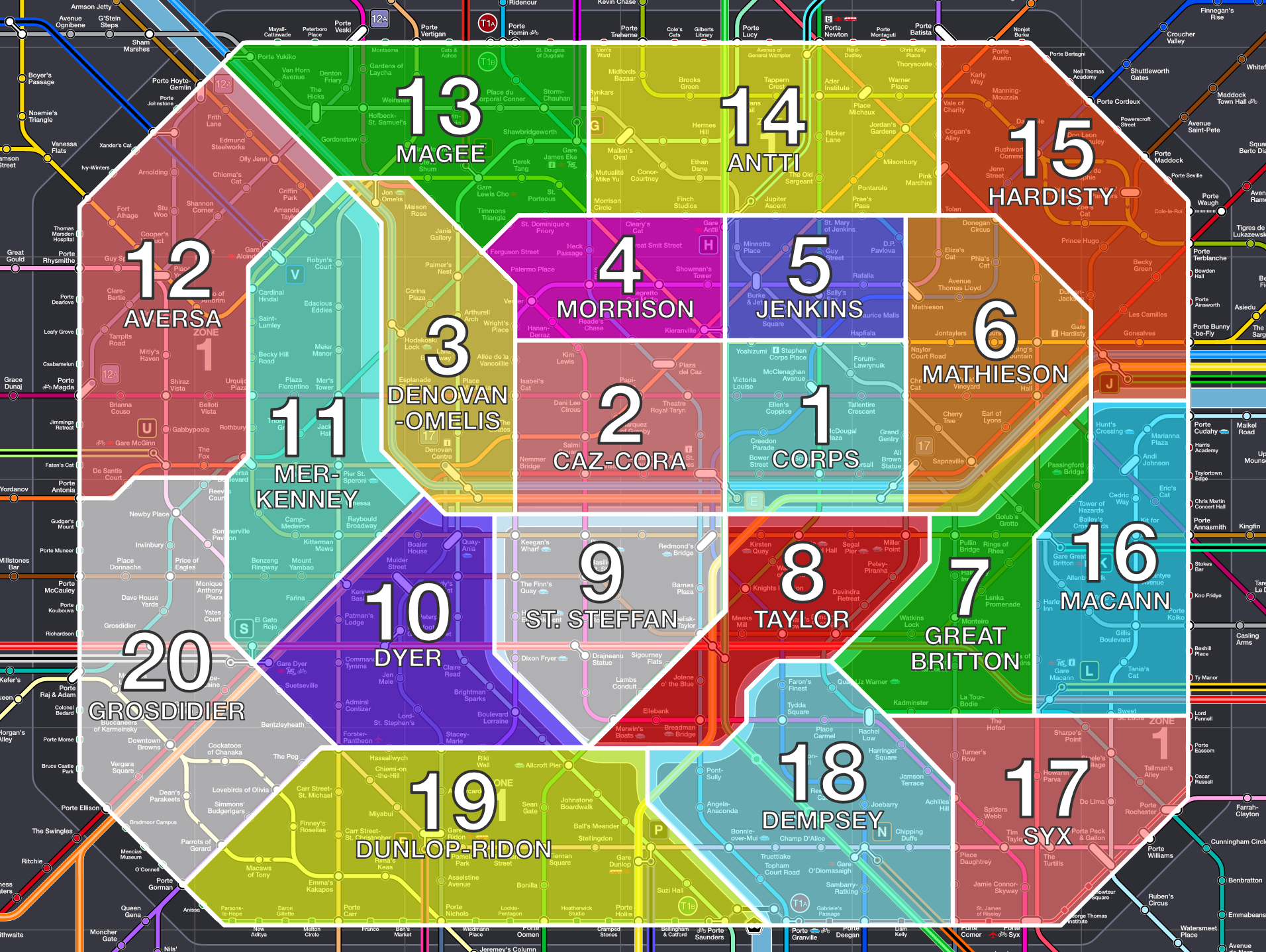
The 20 Arrondissements of Zafarnia, superimposed on the metro map, and all named prominently. Click to enlarge.
Slowly I’m imaging the city above the metro network in my mind, though this is nowhere near as extensive as with St. Jacques, where I have a good idea of the main network of roads as well as an almost fully developed bus network (I intend to do a bus map at some point of St. Jacques in the future).
No lie, Zafarnia is heavily based on the city of Paris (much more than St. Jacques). A ring road circles the boundary of the city (La Peripherique). Just inside, lies a tramway which circles the city as well. In the case of Paris, this circle has not been fully formed (and it likely will never be, the remaining section is in a very posh part of Paris and won’t see much use, plus RER Line C is in the vicinity). In Zafarnia, we have the same thing, except this time we’ve fully formed the loop. On this circle, we have all the named ‘Portes’, which are gates of the city, a feature both Paris and Zafarnia share. Even more blatantly, there’s the island just south of the absolute centre of the city. One user on Reddit commented on my St. Jacques map: ‘lol that’s Paris’. Well, as for this one…
I adore the city of Paris. It almost makes me proud to be French (don’t let my Corsican family and friends know I said that). It’s stunningly beautiful. I try to visit the city at least once a year, of course to explore the city’s transport, and to meet up with friends. One of my best friends from secondary school lives in Paris, and I even met up with my French exchange (a trip from nearly 15 years ago) during my last sejour. I’m taking full advantage of my Eurostar discounts, a benefit from my employment at London Underground. £29.50 single tickets, £59 if you want to splash out with Eurostar Plus, which on the return home, is very much worth it. I wouldn’t mind living in Paris at some point in my life, likely working for the RATP. Possibly this will happen so when my mum, bless her, makes it to a certain age, I will be closer to her; travelling from London to Corsica is difficult outside the summer. Plus, I won’t have to travel far from some damned decent bread.
One thing I like about Paris (other than its eclectic public transport system) is how the city is divided into different arrondissements, all with their unique characters. It’s similar to my fascination for London postcodes and boroughs. I implemented arrondissements into St. Jacques, splitting the central part of the city into 22 arrondissements (I just had to beat Paris’s 20). Outside of Zone 1, where most of my good friends right now are present, the city is split into boroughs and postcodes.
The City of Zafarnia is beginning to take more shape in my head, as it’s now healthily filled. Seeing as ‘lol that’s Paris’, it’s inevitable, I’ve given Zafarnia the arrondissement treatment, though unlike in St. Jacques, I’ve only focused on Zone 1. Outside of Zone 1, the city will be split into towns at some point, like the banlieues of Paris. Each arrondissement has been named too, just like Paris (though these names are very rarely used). The name chosen is usually after one of the more important stations within the area.
20 arrondissements in Zafarnia, arranged logically and each named, the city has now been split up. A rough map has been created, see below.
(Note for Napega, I’ve gone the Prague route instead when dividing the city, the entire greater area of the city has been divided and numbered, i.e. Napega 1 and Napega 2 for the central part of the city, dispersing outwards, mirroring Prague)