Perhaps a convoluted name nowadays, the map was created under the moniker ‘#ProjectFarnhamCity’, but I never intended the name the city as ‘Farnham City’. Farnham screams rural, this city is anything but. This, I quote from someone who saw an early preview of the map.
I eventually settled on Zafarnia after some thought. I’ve always been drawn to names starting with a Z. I had to incorporate some ‘Farnham’ into the name, or part of the word at least. So… Zafarnia.
I’ll keep this brief, as everything is already described in meticulous detail on the St. Jacques and Napega sections of the site (particularly the latter).
A strange kid (in his mother’s own words) develops an interest in the London Underground. His mum periodically brings him back tube maps to collect. A collection of books on the London Underground begins. The highlight of the Saturday trip to the West End is the Northern Line journey between High Barnet and Tottenham Court Road. Tantrums are thrown when his dad offers to give him and his mum a lift to central London instead of them taking the tube.
At his new primary school, in the playground, he conjures up, in his imagination, a fantastical metro system. This system is astronomically vast, a 1,089-line behemoth, however only a small number of lines were fleshed out. Every breaktime, this kid would run around the playground, pretending to be a Northern Line train on the ‘Class Line’, the most completed line on the network. Stations on the network were named after his 30 classmates.
Now a little older, and commencing secondary school, he’d resurrect the concept and create a new metro system, Conapega. With more of an understanding about how metro systems are developed, the network conceived was more grounded in reality, with a far smaller total of 15 lines. With 200 students in his year, that was ample room for named stations. The transport fanatic draws the lines first instead of the entire network, so Conapega is convoluted from the start.
Now heading to university, there was a chance to start from scratch. In school, he had 200 classmates, now there's an entire instituion of 9,000 graduates (and many more post-graduates) to name stations after. The network in its entirety was sketched first, to give the map a semblance of structure. To begin with, 20 lines were scribbled, including a crudly drawn circle to define the boundary of the central part of the city.
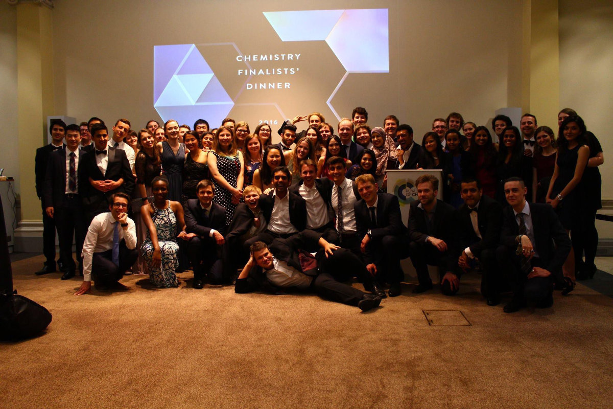
First, the Chemists, his coursemates for the next few years, got early access to the obtaining of stations; plenty of real estate in Zone 1 up for grabs. His fellow inhabitants of the fourth floor of Gabor Hall, one of Imperial’s student halls, would be placed on the aptly chosen Line 4. More stations as he would join several societies, including baseball, were a curious line entirely out of the centre was chosen for station locations (this line would develop into a full ‘Overground’ network). Sections for dodgeballers and members of the Afro-Caribbean societies would also be created.
The chemistry degree would not go as envisaged. Second year was a death knell for any chance of a 2:1, partly because being an active member of three societies at the same time, though wonderful, sidetracks you for what you’re mainly at university for. Four failed exams downgrades him from a five-year Masters course to a three-year bachelor’s course, and university is wrapped up earlier than planned, leaving with a 2:2 and thwarting the planned course of his life. 358 people made it onto the map, which was at this point only about 40% filled.
Well, uni didn't go so well, but at least I had a fab time.
The St. Jacques map becomes an all-purpose map from this point on, being filled in any way possible. Stations for forum members in communities he was part of, ‘N: The Way of the Ninja’ and Deal or No Deal. Nostalgic about secondary school, an area of stations for his closest friends at Dame Alice Owen’s school. Entire areas for his family, both on his mother’s and father’s side of the family. A large section in the northeast dedicated to friends and family in Corsica.
Just because you miss out on a 2:1, a good career is in no way out of reach. His first job out of university is secured, unsurprisingly in the transport industry, initially working for London’s buses, at Tower Transit. More stations handed out, this time in a forgotten corner of the map.
Foundations of adult life now being placed (and being kicked out of the nest), with a secure job, became the rebuilding of a social life. Joining a baseball club to continue the good times playing sports, lots more stations are given. Eventually, from here, he would then join a softball club, one of the UK’s largest, in fact. He falls instantly in love with this club, the London Raiders. With five teams, this is a huge group, so the initial area reserved for Raiders was not fit for purpose. This called for something drastic. At this point, stations are now needing to be displaced out of a new reserved area in the east, to allow for more Raiders, who eventually violently invade and colonise the entire south-east of the city. The social life he reminisced about was now reaching levels it had been during university!
Buses were brilliant, he loved his co-workers, but to survive in London, including the dream of owning a property in the city some day, you need a lot more income. London Underground offers a great career, and a chance was available as they advertise for schedule compilers. Could there be a job that suited him more? To think he wanted to work as an industrial chemist. If he spoke to his younger self now about train timetables, the zealous kid would be ecstatic.
Ultimately, by 2017, with the map nearing a 90% occupancy, a new iteration would need to be developed, with more lines, including several new Overground lines, an expansive Crossrail network, and a more fleshed out tram network. This would allow accommodation of his soon to be co-workers, a larger team than he was working in prior as timetabling trains can be lot more intricate. His social life, hobbies and his new role take up a vast proportion of his time, though he knocks up a rough draft of a brand-new map, unthought of back in 2015 after he graduated.
A pandemic hits in 2020, and the country is locked down. Cut off from the office, social interaction and his hobbies, he’s hit with a heck of a lot more free time. He re-designs and improves on the draft, then takes the plunge and officially starts the new and improved version of the St. Jacques map, taking him almost six months to complete, being released on his 27th birthday, 18th April 2021. At the same time, he finally buys a Mac, re-learns using vector drawing software with a long intended computerised version of the map. This is completed a few months after the hand-drawn version was released.
With life fully back in motion by 2022, he immerses himself in the softball community. By now, the new and improved version is quickly being filled, now almost at a point where space is no longer available. Owning map real estate becomes harder to achieve. Supply and demand? Supply is running out. New lines are added onto the map to catch up with demand, but the situation becomes all too tenuous. At present, 1,662 out of 1,780 stations have been filled.
He realises this. In the back of his mind, a new map would need creating, though this a very long and arduous process. One tournament catalyses the map’s genesis and sketches and planning commences.
St. Jacques is ginormous, and by then a decade old project. However, at the time I was in a period of complete ennui with St. Jacques. So, one of the main reasons for creating a new map was...
At the time I started to create the Zafarnia map, I was in an era of thorough ennui with the St. Jacques Map. I felt a lot more inspired developing a brand-new city’s metro system. I tried to re-invigorate the St. Jacques interest by developing the bus network, but at present I have little desire to pursue this further (as good as Affinity Designer is, it's still too finnicky to create a bus map in the format I want.
The hand-drawn St. Jacques map will always be classic. Charming, stained with the sweat, frustration, and utter time it took (one good thing came out of the lockdown era, at least). I still am quite proud of it, thinking of the best way to preserve it for time.
Regarding the digital version, though it makes the map look neater, more uniform and more professional, it’s far too inspired by the TfL maps – so much so that it leads to much confusion upon an initial glance. Using the Johnstone typeface, as well as the same design features, the logo is also a pastiche of the Transport for London roundel, designed as such so I don’t have to worry about copyright issues (though the official roundel was always intended for St. Jacques in my mind).
People commonly jump to the conclusion that it’s a map based on London, so they try looking for London stations (admittedly there are 17 existing London stations on the St. Jacques Map, see if you can find them all). I get asked questions such as ‘where’s South Kensington on the map?’ ‘Is that the Piccadilly Line?’
When people work out that this map is not based on London, but for a fantasy city, there is an expectation that people are placed on the map relative to where they live in London. Someone who lives in south London would expect their station to be in the southern part of the map, but this is not often the case. St. Jacques stations tend to be placed in locations for a particular reason, usually as part of a set group of people or dedicated line. For more information, refer to the St. Jacques map webpage.
For the Zafarnia map, I wanted to come up with a completely original design, with not one iota of TfL influence. I experimented with different background colours and using 30/60 degree angles instead of the usual 45 degree angle design. I came up with a few of my own ideas, and took inspiration from looking through the TransitMaps (transitmap.net) blog.
 |
 |
Shown above: some of my draft designs for the map. The 30 degree angles do look interesting, I'm looking to incoroporate this into my next map, Project Napega.
Side note: The St. Jacques map has featured on this website! Version 4, to be exact had its own entry. The blog author took the map from my Flickr page, and from their words, had been following the St. Jacques project for a while. I was never notified and discovered this blog post by myself around the time I had finished the current hand-drawn version. I do wonder if TransitMaps has seen the latest version, which is a huge improvement on version 4! https://transitmap.net/st-jacques/
One map in particular on this blog caught my eye – an unofficial NYC Ferries map by Evelyn Fischer. https://transitmap.net/nyc-ferries-evelyn-fischer/ This map was quite beautiful – a relatively dark background and brightly coloured lines which popped out beautifully on the diagram.
This map would be my largest inspiration, and a similar design would be incorporated for the Zafarnia map. This time, with the lines on a gray background instead of a blue background, using a different typeface and different representations for station markers and interchanges.

Possibly the very first sketch that exists of the map.
As always, I plan my maps through rough handdrawn scribbles with coloured pencils, and Zafarnia was no different. It took at least fifteen tries until I drew something I was happy with. Slowly, this sketch would be transformed digitally into a new map, which would eventually be finalised. There, I could start the process of adding stations.
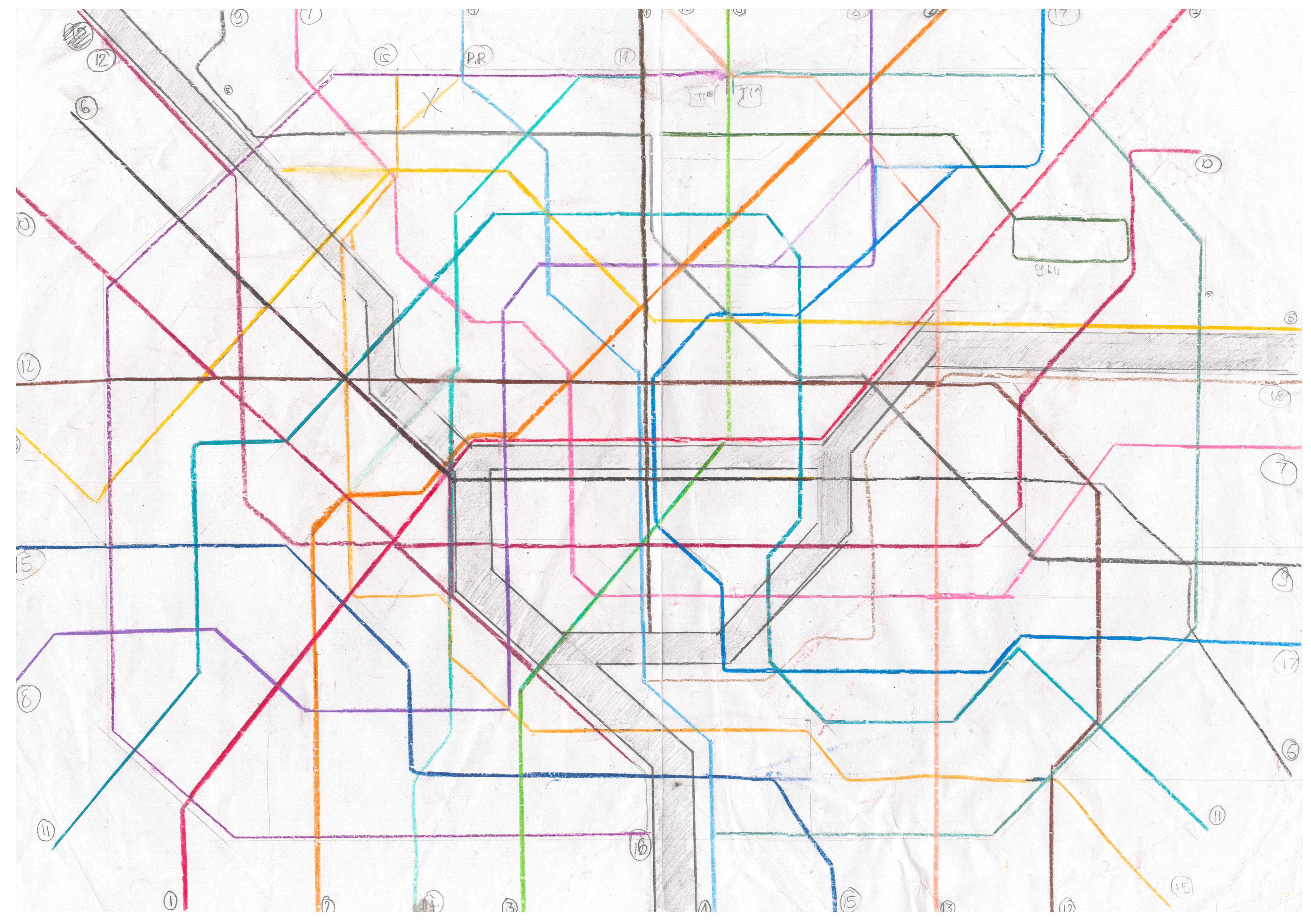
Initial rough sketch is shown above, already looking similar to the map it became.
I was quite pleased with the new design, it may have its flaws but it looks quite striking. Besides, dark mode on apps has become popular, and a lot of software these days tends to default using a dark interface. The typeface I initially chose for the map, 'Transport' (used on the UK's road signs and the London Borough of Hackney's street signs) was something I was not 100% happy with, and I made the decision to change to classic Helvetica for Version 2. It gives the diagram a little more class. New York doesn't own Helvetica!
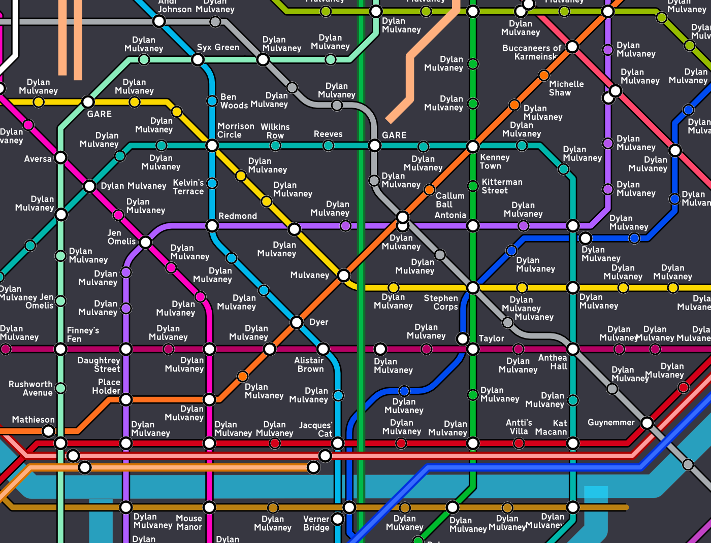
Design idiom finalised, the map starts to be sketched out. Initially the lines were a lot thicker! It would prove to be tough to add stations without the map looking incredibly busy and cramped! I showed the map in this form to someone and very useful feedback was given to make the lines narrower. For some reason I used the name 'Dylan Mulvaney' as a placeholder...
Version 1 was released in March 2024, just prior to the softball season - with the initial intention of updating the maps twice a year, once before and once after the outdoor softball season. Indeed, after a chaotic season of softball, the second version of the map, which included a brand new index, was released, with 187 new additions.
The waiting list quickly grew after the released of Version 2 (by that December, if I remember correctly, 50 people were on the list of future additions). I didn't get round to releasing a Version 3 before the 2025 season, and opted to see the softball season through before developing Version 3. Indeed, the season was incredible and the list grew to over 200. Yet again, another map in danger of overcrowding...
To figure out how I'm going to future-proof the map, there is a section on the Miscellaneous page of my site.
With most of the stations in central St. Jacques being filled in early on in the maps existence, my current friends tend to find themselves outside of the centre. True, there are tons of great locations outside of central London, in fact I tend to avoid central London when I can except for work, too full of tourists. There is nonetheless an expectation that people want to be in the centre of the city! I have had complaints from people that their stations were right near the end of the line, in Zone 5, where they should have been in Zone 1 – in fact many close friends currently find themselves in zone 4 or 5.
Life happens, and friendships fade away. I haven’t kept in contact with many of my course mates in chemistry, though I would like to do this more. Counting the number of fellow students and professors that were assigned stations in central St. Jacques – I make it 194 people. Since 2020 of these 194 people, I have only interacted with 23 of them (including one rather tense argument on Facebook), whether online or in real life. Of these 23 people, I have only kept in regular contact with seven of them.
Perhaps in times, more connections will be re-kindled; however, it is nearing 10 years since I left university. People move on with their lives, and I’m sure a not insignificant number have left the country. Surprisingly, with softball and baseball being a huge part of my life at present, I have not been in regular contact with a single teammate until this year. Perhaps I left the Imperial Falcons Baseball Club in bad blood when I left university. But there is one player from the Falcons who now plays softball in London - now playing for Bangers & Smash. It's great to see him (and talk about the memories with the Falcons!)
 I haven't seen any Falcons of my time play baseball after university. Where they at?
I met a few dodgeball players who played in my time at university when I returned to dodgeball briefly, joining London Storm. My goodness, the standard of dodgeball there is incredible, perhaps a little daunting for a novice (though their social sessions are very, very fun and a good way to get some exercise during the week). Imperial College and London Storm seem to be quite intertwined, often when I do on occasion make it to the social session, there are many current Imperial students in attendance. They are full of energy any get me out all the time. I think it’s a sign I’m starting to get older.
Though dodgeball is no longer a big part in my life, namely as I'm getting older, more prone to injury, and find it very hard to keep up with the younger players, I was speaking to more dodgeballers than baseballers post-uni, even though baseball was my main society at university! I don’t have much of close kin with the Imperial ACS members, though we do like each other’s posts on Instagram every now and again.
It would definitely be worth rekindling some old friendships. Perhaps in the future…
Zone 1 is therefore full of people who I have not spoken to for almost 10 years. I think this odd phenomenon can be represented best by this example. Travel two stops on Line 4 from Jacques Central. This station, an interchange station no less, was for someone in my university halls. I liked him at first, but it dawned on me that he was hardly my biggest fan. Every time I would try to speak to this person, they would make the strangest facial expressions in response mostly of despondent irritation. And he's right there in the centre of the city.
Not a single softballer finds themselves in Zone 1 on the St. Jacques Map, considering as this is now my most closeknit community. With that cognisance, a new map was required. St. Jacques was outdated. Hence, Zafarnia was created.
I started slowpitch softball officially in 2016 (I had dabbled previously, dating all the way back to 2005!) This branched out from my baseball ‘career’ which I began in 2012 at university, as an Imperial Falcon. I didn’t leave the Falcons on very good terms (there was a lot of drama involving me being stuck in right-field), but I still wanted to relive my university days now I was in full-time work. I joined the London Mets club and made it onto their new Single-A team, the London Mercenaries. Consisting of a close group of fresh new players, many from the Baseball for Beginners programme, I was one of the late additions drafted fresh from university. It was great to be back on the field, and with that brought the greatest irony. With the frustration and arguments stemmed from being perpetually stuck at right-field when playing baseball at university, even during friendly games; I became a solid leftfielder for the Mercenaries and my love for outfield officially began. I did not play a single game in right-field in league from 2016 until 2021, and even those were very rare occurrences (once a season, and in most cases not even for a full game as I was moved elsewhere within two innings).
Fun fact, my first ever softball tournament, at Farnham Park, was in 2014 – long before I joined the Raiders. A much familiar face organised this – the National University Softball Championship, run by none other than Liz Knight. I was representing the Imperial Falcons. I can vividly remember that it was an absolute blast and was more enjoyable than the baseball games. I got to play two softball tournaments with the Imperial Falcons. It also was a very rare instance of me being away from right-field, since ‘outfield is more important in softball than baseball’, according to the captain (he never did have much faith in me, it surely wrecked my confidence…) the first tournament we didn’t have any women and were rightly penalised, so for our second appearance, women joined our roster. I think that tournament is the greatest contender for fun baseball/softball game I ever played during my university days. Was it a hint which would reveal my adoration for slowpitch softball?
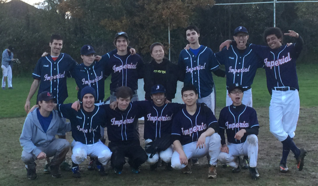
 One of the best days with the Falcons - my second time at Farnham Park, when Field 1 as we know it today didn't exist.
In 2016 my outfield neighbour Tom always stood guard in centerfield. As it would turn out, he also played for a softball club, the London Raiders. He recommended that I check it out. The softball tournies in 2014 were a lot of fun, and I was looking to make some more friends and build some more new social circles. The London Raiders were an LGBT club, and I had recently come out (perhaps it was obvious to outsiders, but it's always good to officially come out). This would be a perfect group to join, at the right time too. I attended the ‘Meet the Raiders’ party and that was more than enough to convince me to become a member. A lovely bunch of people they were. They would be one of my close social groups, to this day. It wasn’t just softball, I would be going to their houses for some games nights, and even went camping with a few of them.
It was utterly ludicrous at first, but I had initially assigned a section of map for the Raiders. This would be a small slither of map between line 8 and line 11 in the northeast outskirts of the city. It quickly transpired that this was not close to enough space for this group of people. As proof, check the east and southeast of the map, under the river – there’s your answer. New lines and tramways have had to be created specifically for the Raiders (and eventually, more softballers). To this day, there are just over 200 Raiders on the St. Jacques Map (and a further 130 other softballers).
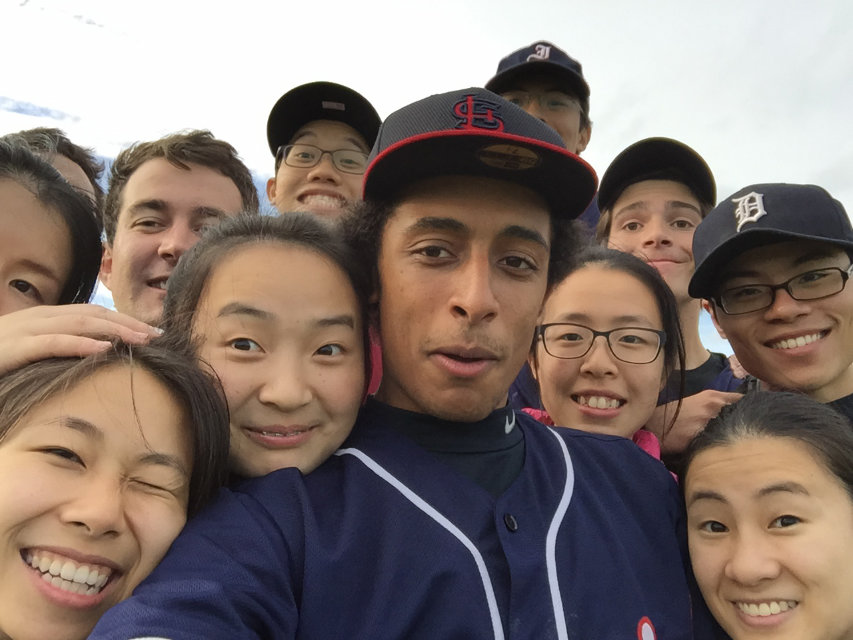
 Orange days.
My first official softball tournament would be in 2017, Firstball at Chiswick. I lacked an interest in tournaments at first, only being coaxed by Gustav to attend (the venue was an absolute pain to find). In 2018, I would finally return to Farnham Park to play in the Diamond tournaments with the Raiders. It was softball paradise. 12 fields in use, amazing weather and two Raiders teams competing.
Discoball 2018 was the absolute turning point, one of my most fondly remembered days at Farnham Park. In contrast, the very next day, I had my baseball mental breakdown. Thus came the ‘sliding doors’ moment and my gradual transition to softball.
After the worst of the pandemic was over, and softball could return, I would sign up for more tournaments, reducing my baseball playing time. One tournament in particular, Windsor 2022, was pivotal. After this iconic weekend was through, I would declare 2023 as the ‘Year of Softball’, where I’d sign up for as many tournaments as possible. The 2023 season was absolute perfection.
Too much of a good thing is possible, and a dose of anxiety would manifest itself for the 2024 season. Too many tournaments fatigued me, and status and politics marred the joy of the sport. 2025 has been a lot better, almost reaching the heights of the monumental 2023 season. I hope that 2026 will be even better. I plan to return to playing with Raiders for the competitive team in tournaments much more often (though I still would like to play for Thames Valley as well). I hope that I can improve on my standard with the Fuzzy Ducks as we return to NSL 2. For LSL, I can’t decide whether I want to play for Gold; there could (and I stress, could, as Jeff is a better player and rumours are he's already been asked. I think I’ve got to be an absolute shoe-in for the higher tournament team, so it’s alright), or continue Raiders Blue’s story as we stand strong in a division that becomes increasingly tougher, and with Gold looking to nab players off our team.
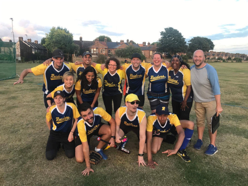
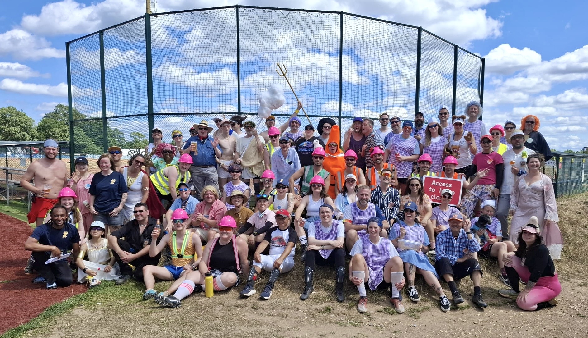 Raiders Tournament 2025. As expected the Raiders get the greatest share of the map!
We shall see. The 2026 season has been named ‘Tens Across the Field’ as this will be my tenth full season in softball. Hopefully the year will be ‘tens, tens’ tens across the board’. It could prove quite tumultuous, not because of the Raiders politics, but the unstable situation of Farnham Park and BSUK. The Wickham Wonders… ahem… Wycombe Wanderers have announced a partnership with Buckinghamshire council to ‘secure the future of Farnham Park Playing Fields’ – sounds quite ominous. All I’ll say is, make sure our dirt pitches are left unscathed. Quite frankly, you have the whole country to play football, let us continue to play softball at Farnham undisturbed…
In these ten years, especially the last few, where I immersed myself even more in the softball community, it’s been incredible to witness just how many people play this amazing game, and it’s great to see baseball and softball expanding. I’ve loved maintaining this map, perhaps even more so than the St. Jacques map.
894 softballers. This number could reach 1,000 by 2026. Only 106 unclaimed stations remain.
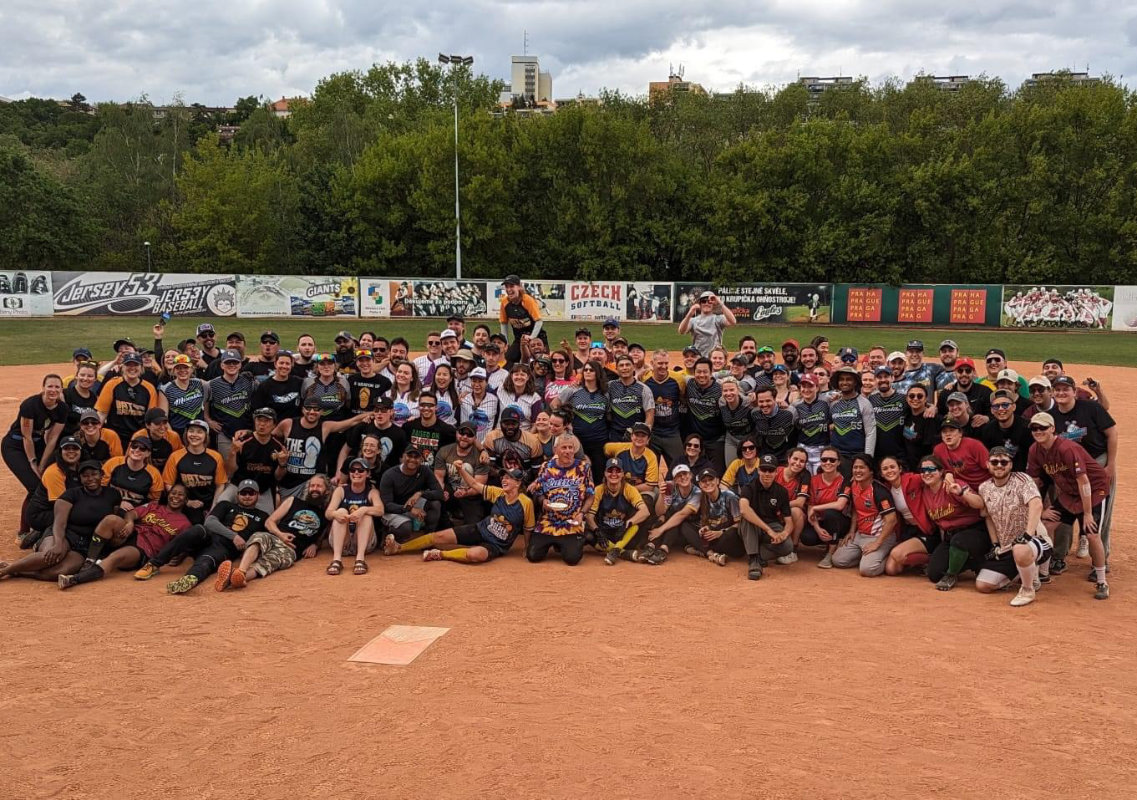 Softball at Prague in 2024 - this photo was all of the teams from the UK. That'll fill a map...